Rover
-
Content count
326 -
Joined
-
Last visited
-
Days Won
7
Everything posted by Rover
-

-
-

-
-
CREACIÓN BÁSICA DE TERRENOS PARA SFP1/SFG/WOV/WOE/WOI ¡¡¡Hola a todos!!! Aquí está lo prometido. Dado que muchos miembros del foro en español desean crear sus propios terrenos, yo elaboré este tutorial para crear terrenos utilizando los archivos del mismo simulador. Está demás decir que espero que les sea útil, que utilicen este topic para plantear sus dudas. En este caso, vamos a crear un terreno completamente nuevo desde cero y les aconsejo que lo vayan haciendo también ustedes para que el tutorial sea totalmente práctico, aplicable y sobre todo para que quede bien grabado los conceptos de creación. Gracias por la paciencia. ¿Cómo se pueden crear terrenos completamente nuevos de la nada? El truco es este: El Servicio Geológico de Estados Unidos (USGS, del inglés: United States Geological Survey), provee en forma gratuita lo que se llama Mapa de Elevación Digital (Digital Elevation Maps o DEM). Estos archivos se usan como un recurso para recrear paisajes y diversos sectores del planeta en 3D, ya que la información está tomada de satélites. O sea, es información de gran calidad y un recurso NECESARIO para poder recrear CUALQUIER parte del planeta. Simplemente deben seleccionar el sector que les interesa y descargarlo. Se debe descomprimir en una carpeta aparte. CONSEJO: descárguense todos los DEM y descomprímanlos todos en una misma carpeta llamada "DEM" para tener todo el planeta tierra en nuestra PC. Aquí les dejo el link: http://edc.usgs.gov/products/elevation/gtopo30/gtopo30.html PREPARADO EL MATERIAL Aquí vamos a juntar las herramientas necesarias para poder crear un terreno completamente nuevo. 1- El "Terrain Editor" (recomiendo la versión mas moderna), lo pueden descargar aquí. 2- El extractor de archivos .CAT para poder utilizar los archivos originales del simulador. Lo pueden descargar aquí. 3- Un editor gráfico al estilo Photoshop, (yo personalmente uso PhotoFiltre y Gimp 2, ambos totalmente gratuitos.). 4- El editor Windows Notepad. El paso siguiente es la creación de una nueva carpeta dentro de la carpeta "Terrain" de nuestro simulador y la vamos a renombrar escribiendo el nombre del terreno a crear, en este caso, será "BuenosAires". Ahora, tomando como ejemplo el terreno "GermanyCE" del WoE, vamos a extraer TODOS los archivos pertenecientes a los "azulejos" o "Tiles" y vamos a llevarlos a la carpeta "BuenosAires". En total son 275 archivos y se componen de los siguientes tipos: Archivos .BMP del tipo RGB: Son archivos de mapas de bits de 256x256 pixels. Representan un área de 2x2 Kms. Por ejemplo: GERMANYRG50C.BMP Archivos. TGA: Son archivos de mapas de bits de la misma resolución y abarcan la misma cantidad de espacio del terreno, pero con el adicional de tener una capa denominada "Alfa" y sirve para agregar transparencias. Estos archivos se usan para los azulejos que representan las costas, ríos y todo lugar donde haya agua. Por ejemplo: GERMANYJ-RIVE2.TGA Archivos .BMP del tipo "Grayscale" (escala de grises): Son archivos de mapa de bits de 16x16 pixels y estos son los encargados de definir la altura de las costas, ríos y son los que le dicen al sistema en que parte del azulejo hay agua y en donde tierra. ¿No han realizado un barrido con ametralladoras a un río y donde había agua, afectivamente salpicaba agua? Ejemplo: GERMANYJ-RIVS1_HM.BMP Archivos .TOD: Son los archivos encargados de ubicar los arboles y los edificios "básicos" dentro de un azulejo. Por ejemplo: GERMANYJ-RIVS1.TOD IMPORTANTE: La descripción de diferentes tipos de azulejos y su creación conforman un tutorial aparte, ya que consumen gran cantidad de tiempo hacerlos "desde cero" y extendería innecesariamente este tutorial. Ahora, con el programa editor de gráficos, abran todos los archivos .TGA y guárdenlos como archivos .BMP. Es muy aburrido hacerlo, pero es necesario para que el editor de terreno funcione correctamente. Bien, hasta aquí, estos son las herramientas necesarias para realizar un terreno completamente nuevo. En el próximo tutorial les voy a explicar los primeros pasos de la creación acompañado de unos bonitos screenshots como complemento, aunque me imagino que en este momento ustedes deben estar experimentando. Los tutoriales se van a suceder en forma diaria, o sea, mañana tendrán la próxima parte. Saludos!!!! Rover Mirage
-
South Atlantic Theatre of Operations
Rover posted a topic in Thirdwire: Strike Fighters 2 Series - Mods & Skinning Discussion
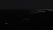
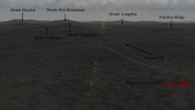
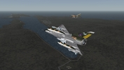
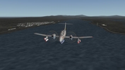
Hello everybody!!! Some years ago I've started a new terrain for be used on Kesselbrut's "Falklands All Inclusive MOD". Now, I'm back for finish this terrain for SF2. This are some screenshots of this project: Banidos Team Mirage IIIEA Flying over Puerto Argentino/Port Stanley. Malvinas Military Airbase (BAM Malvinas)/Stanley Airport. Parked Aermacchi MB-339A (MB-339A 3D model made by me, skin made by Torno) Parked IA-58 Pucará (Pucará 3D model made by me, skin made by Torno) BAM Malvinas/Stanley Airport control tower. Hercules approaching. Hercules landing. Parked Hercules. Sea Harrier attacking BAM Malvinas. Fitz Roy/Buff Cove. Darwin/Goose Green - Condor Military Airbase (BAM Cóndor)/Goose Green Airstrip) British frigate probiding artillery ground fire support over Goose Green. Pucará in CAS mission over Darwin. Harrier Gr.3 in CAS mission. The ground battles will be fought in all "historic" places, such as Goose Green, the mountains Longdon, Williams, Harriet, Tumbledown, Wireless Ridge, Two Sisters, Top Malo House, Sapper Hill and even the assault made by SAS on the Naval Air Calderón (Plabbe Island) . In all cases we can provide close air support. Canberra going to battle. San Carlos water. San Carlos FOB. Well, this is it until now. More screenshot will be added while I finish this project. I hope you like. Regards. -
Questions about SF2 NA terrain files
Rover posted a topic in Thirdwire: Strike Fighters 2 Series - Mods & Skinning Discussion
Hello!!! I've extracted some files from IcelandNA terrain and I found some files Does anyone know the function of the ICELAND_DETAIL_MAP.bmp file and how it works in the the terrain? Beside, in the IcelandNA.ini file is a line: LocationMap=IcelandNA_Location.bmp Does anyone know the function this BMP file and how it works? Than you very much!!!! Rover -
South Atlantic Theatre of Operations
Rover replied to Rover's topic in Thirdwire: Strike Fighters 2 Series - Mods & Skinning Discussion
Hello CowboyTodd41 No, the default campaign will not work with this terrain because some target areas are different than the original terrain, and the scale of the terrain is bigger than the original terrain. So, the strategic nodes and the frontline changes. For fix this problems, I will include a new campaign file as an extra item of my terrain. Regards -
South Atlantic Theatre of Operations
Rover replied to Rover's topic in Thirdwire: Strike Fighters 2 Series - Mods & Skinning Discussion
Hello cangas! Is a totally new terrain! -
South Atlantic Theatre of Operations
Rover replied to Rover's topic in Thirdwire: Strike Fighters 2 Series - Mods & Skinning Discussion
Hello guys!!! I'm still working on the terrain!!! This is a video about my work. I hope you like it: http://youtu.be/q_v3g03cbwo Regards -
SFP1 running on Windows 7
Rover replied to Wilches's topic in Thirdwire: Strike Fighters 1 Series - General Discussion
Hello!!! I've installed SFP1 on D: gerd drive, I've patched to 2008 version but, two things happend: 1) I can't set the screen resolution (there appear no options for that). 2) When I want to play any mission, the sim crashed to the desktop. I can't find the post in Knowledge Base, and I wish ti install SFP1 on W7 for multiplayer gaming!!! Thanks!!! -
South Atlantic Terrain
Rover posted a topic in Thirdwire: Strike Fighters 1 Series - Mods/Skinning Discussion
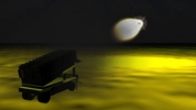
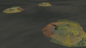
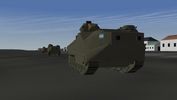
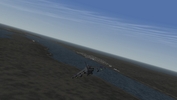
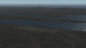
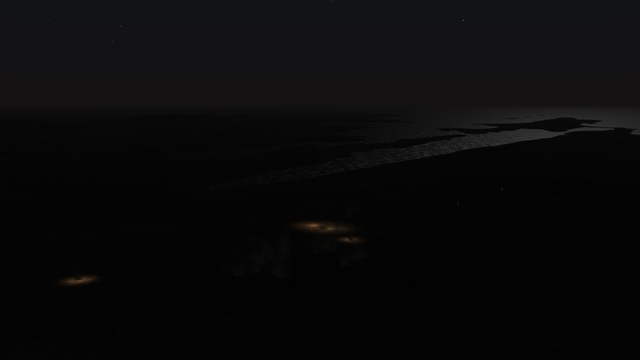
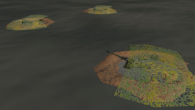
Hi everybody, i want to consult for a question: When I joined this forum, i was very impressed with all the people who worked bringing new mods and other things and i want to cooperate. Obviously, as an Argentine virtual pilot, i have downloaded versions of the Malvinas/Falklands terrain and campaign. I know that there are people who are working on a new version (a very good version) of this campaign. However, i have to build a new version of this terrain. These are their features: Custom instalation: You can install this terrain in two different languajes, spanish and english. And you can choose the side (Argentine or British side). If you choose the Argentine side, the name of the cities and places will have argentine names (Malvinas Islands, Puerto Argentino, etc); if you choose the British side, the same cities and places will have british names (Falklands Islands, Port Stanley, etc). Weather and textures: I trying to made this terrain on autumn season and most realistic as possible. The pilots will fly on bad weather, low visibility, and just a few hours of daylight. Geography: The terrain will respect the locations of cities in the islands as an Argentine Patagonia, as well as roads, rivers, etc.. Historical Truth: You will use the same airbases that were used during the war. In the same way, will be many targets zones where they may add to the Task Force, navigation routes, etc. New target zones: New targets zones on the Argentine Patagonia and other places, this would make the game more interesting. When doing this field, a lot of information was consulted (books, photos, videos, etc.) but, may be this terrain is incomplete: i am not a 3D modeler so, i call all the people who want to collaborate and make this terrain more interesting. Remember: is NOT a campaing, is just another version of the terrain. Turning to the question that I wanted to do: do you want this terrain? This are some pics of the terrain (on good weather): Now, another pics over the sea: See you! -
South Atlantic Theatre of Operations
Rover replied to Rover's topic in Thirdwire: Strike Fighters 2 Series - Mods & Skinning Discussion
Hi SgtSaunders!!! Post updated!!!! Regards -
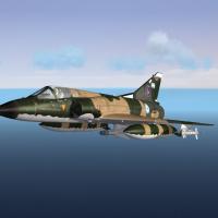
From the album Rover's MODs
-
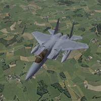
From the album Rover's MODs
-
South Atlantic Theatre of Operations
Rover replied to Rover's topic in Thirdwire: Strike Fighters 2 Series - Mods & Skinning Discussion
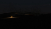
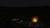
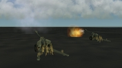
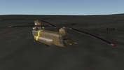
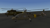
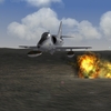
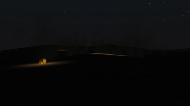
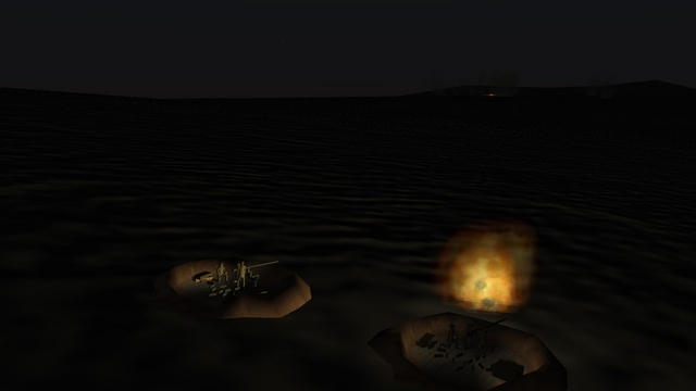
Hi everybody!!! Still working on this MOD. Today I will present: Puerto Argentino/Port Stanley: Pucara flying over Puerto Argentino/Port Stanley. Bnidos Team's Mirage IIIEA over Puerto Argentino/Port Stanley Sea Harrier attack rum. Argentine Army helos near Governor House Prefectura Naval Argentina (Argentinie Coast Guards) helo. Argentine Army Chinook Argentinian Marines. Mountains surrounding Puerto Argentno/Port Stanley: in them, you can recreate CAS missions for ground troops for both sides ("Monte Dos Hermanas" means "Two Sisters Mount") Artillery Duel Testing the Exocet laucher on the new terrain: ...and it works fine!!! So, I hope you like it!!!! Regards... -
From the album Rover's MODs
-
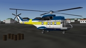
Images of my work in progress of my MODs.
-
-

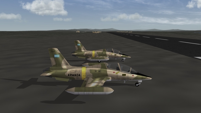
From the album Rover's MODs
-
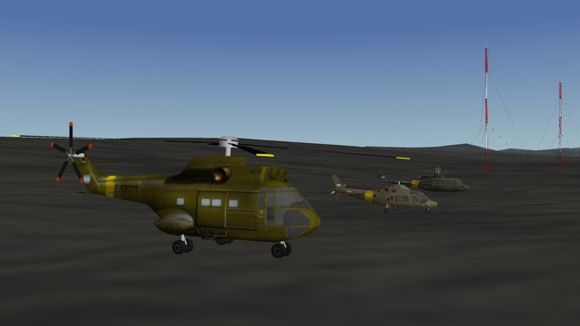
From the album Rover's MODs
-
From the album Rover's MODs
-
From the album Rover's MODs
-
From the album Rover's MODs
-
From the album Rover's MODs
-
From the album Rover's MODs