-
Content count
8,481 -
Joined
-
Last visited
-
Days Won
99
Content Type
Profiles
Forums
Calendar
Gallery
Downloads
Store
Everything posted by Stary
-
- 4 comments
-
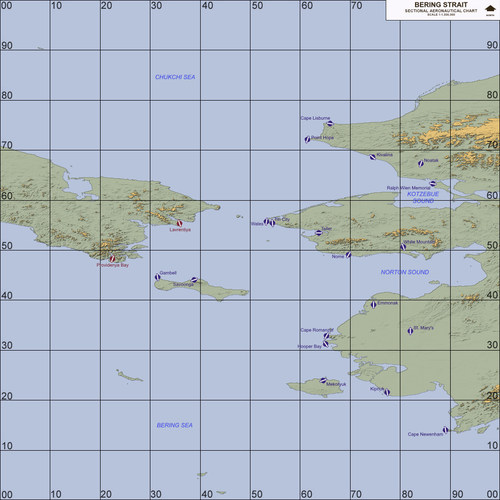
- bering strait
- dbs
-
(and 3 more)
Tagged with:
-
Version 2.02
2,136 downloads
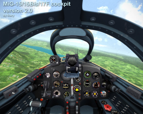
This is updated version of Mig-15 cockpit This package is preset to be used with stock Thirdwire Mig-15 bis. "Expansion Pack I" required for Mig-15 several things changed in version 2.0 among them: stick added pedals added corrected gunsight a bit slightly adjusted, smoother canopy framing new slightly better and higher resolution textures for baked materials more real-size lamps other tweaks here and there original mod description: Credits: TK,Thirdwire CrazyHorseB34 -betatesting Crusader, Ravenclaw_007,RussoUK, Zurawski -for max examples and help on the way Mod description: This is simplified Mig-15/Mig-15Bis cockpit. Very similar to non-radar equiped Mig-17 one. Please note there are some issues with some instruments despite my battling with the ini horror -feel free to tweak and share! -

Strike Fighters modern combat for PC
Stary replied to logan4's topic in Thirdwire: Strike Fighters 2 Series - General Discussion
no siasran, I think not, but sveral variants of Hornets etc -

Battle of the Bulge Terrain [maybe]
Stary replied to baffmeister's topic in Thirdwire: Strike Fighters 2 Series - World War II Forum
WOW -

making a pit
Stary replied to colmack's topic in Thirdwire: Strike Fighters 2 Series - Mods & Skinning Discussion
Colmack I think I posted some max examle files for some of my old (and crappy) cockpits in modders repository, pretty sure MiG-15 one from 2012 and maybe some other WW2 ones, heck I think the WW2 generic cockpits pack had some max files left in for the very basic learning purposes -

Well lookie here...
Stary replied to tn_prvteye's topic in Thirdwire: Strike Fighters 2 Series - General Discussion
hmmm much drama missed I edit: ok not a biggie;what is nice is that TK wrote there that he is open to making more PC games -which, even is similar to these is always welcomed, amirite? -

Well lookie here...
Stary replied to tn_prvteye's topic in Thirdwire: Strike Fighters 2 Series - General Discussion
Clearly you never bought a game with actually zero support post launch from developers, talking AAA studios, there are too many a examplesif by "state they are in" you mean lack of aerial refuelling, yeah dream on edit: typo. Supoort is a gravitational phenomena in Oort cloud -

Well lookie here...
Stary replied to tn_prvteye's topic in Thirdwire: Strike Fighters 2 Series - General Discussion
10K for Thirdwire per plane is pretty sane and plausible number -remember that single plane (module) for DCS is around 80K-100K to develop -

Strike Fighters modern combat for PC
Stary replied to logan4's topic in Thirdwire: Strike Fighters 2 Series - General Discussion
That attitude is gonna give you and all others SF 2 Exp3 or edit: SF3 in no time for sure sheesh you guys... seems actually no one but me bought it? -

Strike Fighters modern combat for PC
Stary replied to logan4's topic in Thirdwire: Strike Fighters 2 Series - General Discussion
nope, all I can say is it is one popular mesh exchange but isn't LOD format -

Strike Fighters modern combat for PC
Stary replied to logan4's topic in Thirdwire: Strike Fighters 2 Series - General Discussion
OK guys, this is Unity game -not even Pro edition- so if any of you do know how Unity deployment works you then know it takes a bit of shady at best workarounds to extract data back to core PC format, I won't say I am looking into it at the moment edit: because of course I do not -

Well lookie here...
Stary replied to tn_prvteye's topic in Thirdwire: Strike Fighters 2 Series - General Discussion
they are back releasing on PC though -

Well lookie here...
Stary replied to tn_prvteye's topic in Thirdwire: Strike Fighters 2 Series - General Discussion
sorry have to disagree with few exceptions, TWs models STILL are looking very good, suprisingly even considering their mileage -

Strike Fighters modern combat for PC
Stary replied to logan4's topic in Thirdwire: Strike Fighters 2 Series - General Discussion
I am downloading it ATM, will see but I pretty sure know what to expect so don't think of it as new SF lol -

Hey, Stary...Could You Do Us a Favor?
Stary replied to PFunk's topic in Thirdwire: Strike Fighters 2 Series - Mods & Skinning Discussion
can't you reorder palette in paint program? Or invert the colours? Sorry for late reply been away -
is it still in the works or been released?
-

Hey, Stary...Could You Do Us a Favor?
Stary replied to PFunk's topic in Thirdwire: Strike Fighters 2 Series - Mods & Skinning Discussion
that green orange looks like inverted -greens should be low areas and the more orange the higher, maybe inversed pallete? It can happen in some paint programs -

1st Look: Aegean Sea v0.2b & HAF Su-30MKG Flanker
Stary replied to PFunk's topic in Thirdwire: Strike Fighters 2 Series - Mods & Skinning Discussion
impressive but I womder how much of the original data is either lost or exagerrated this way -not big issue given my 250m tests were also relying on heavy creativity work with original DEMs -

Hey, Stary...Could You Do Us a Favor?
Stary replied to PFunk's topic in Thirdwire: Strike Fighters 2 Series - Mods & Skinning Discussion
yup PFunk it is in the readme for Kamchatka, wonder what Menrva's method is, mine is so-so heightmap trickery but anyway I'll simply copypaste from readme here: "Extended information, please read carefully! The height mesh: The stock Thirdwire .hfd terrain format uses publictly available DEM (digital elevation model) databases to produce 500 meters vertex spaced terrain meshes with 2000 meters tiles covering them. This is proven, easy to use system but 500 meters is awfully 1999 technology for 2016 systems. Thus given my efforts into NA LOD-based terrains creation stalled due to lack of knowledge and tools I decided to reproduce one of more interesting yet obscure maps available, the Kamchatka Peninsula. The mesh in this download currently uses 250 meters resolution which is twice the density and detail* compared to original terrain. Please note that due to being based on low resolution hfd file output the actual height representation is somewhat off compared to real terrain! Not much and not that it really matters much. "If it looks good it is good" New heightmap was created in several steps which I now describe to help other more advanced terrain modders possibly use this method: First steps -Gerwin's TFDTool and Photoshop: -I used Gerwin's TDF tool to output the heightmap via F9 key -Also created the textures bitmap as a helper file via F7 key -The created file in grayscale is 3000x3000, which corresponds to 500m resolution on 1500000m map (3000/2=1500! Magic!) -Thus I rescaled the file to 6000x6000 pixels, the same with the texture bitmap which I copied to greyscale file for reference -The 6000x6000 or twice the original is the 250m per pixed heightfield file -I filled the blue water areas TFDTool creates with pure black 0,0,0 -Then I spent some time in Photoshop working on several layers and using several brushes and tools to slightly tweak the grayscale height image, mostly to brighten the higher areas and adjust some more interesting places. Mostly blur, stroke tools and some slight wave-y filers to add some detail to now ARTIFICIALLY pumped up resolution (further on this below) -Pro tip: to get rid of any water/shore artifacts is easy way, the so called tsunami waves or coast areas on slopes I selected the texture map layer, selected all water areas (select by pixel color) and created another pure black layer on top of the main height layer, that drops slight shadows around it (2 to 4 pixels black shadow) -this way the heightmap gets toned down for few pixels (two is good value) when near the water areas; think smart not hard as The Ancient One says :P when the heightmap was considered ready I flattened it and converted to 8bit palleted file using the stock Thirdwire terrain editor palette (you can do this palette by exporting any heightmap as bitmap from within the TE and saving it's palette to file, most programs allow palette saving) Second step -Thirdwire Terrain Editor, the 042106 version: so now I had the TE-format palleted 8bit heightmap but to import it without further data loss I needed to adjust the TerrainEditor.ini settings via notepad: -the line that specifies the min-max scale of height present in the file is this line: [bitmapImport] HeightScale=15 <---- this line, by default uses value of 10 MinLandHeight=0 <---- by default 1 experimenting with this value gives you the similar results as using PGUP/PGDN keys when using Gerwin's bmp2tfd tool, basically sets the global vertical scaling of min-max values in file To create new 250m resolution the values at creating new map are as follows: Terrain Map Size: 1500 (km, like original Kamchatka terrain) Texture Tile Resolution: 2000 (meters, like all common SF2 maps and tilesets) Height Field Resolution: 250 (meters, compared to defaul 500 meters) Then if you do have the texturelist loaded yo ushould get new flat terrain with textures filling the areas, just impor t he heightmap from the created 6000x6000 paletted bitmap and save. This is basic procedure, same can be used to create 125 meters resolution terrains (I did so for Korea3 terrain so far) BUT those are unstable and I am still trying to get perfect values in BOTH flightengine.ini and given terrain's _data.ini *now the heihgt information/detail gets lost every time we index the heightmap so one must then increase the HeightScale= value to get more or less proper -OR GOOD LOOKING height values. Also be warned that Gerwin's TFDTool doesn't properly translate non-standard maps (1000 kilometers ones go ok though) that is why the TE hassle That said -the height scale is a bit OFF in this map so if you are a purist complain all you want, I wanted better looking mesh more than geographical accuracy. To have the latter we need to come up with otehr height data sources for denser terrains. I have yet to look into the tools and programs I own what could be of use." hope that helps


