
Stary
-
Posts
8,500 -
Joined
-
Last visited
-
Days Won
100
Content Type
Profiles
Forums
Gallery
Downloads
Store
Everything posted by Stary
-
guys, could someone with the knowledge (=everyone but me apparently) name all the ships we have in the new 3 shots?
-
SZ, you're mistaking TODs with HFD I think
-
on page 2
-
yeah, the stinky TODs will be gone I hope
-
Slight suggestion Slarti One for dev's and modders should be merged with the one for the manic, obsessed people... for as we all know they are the same individuals trust me, I'ma modder
-
we need 5 at least... the more new threads about it, the closer NA will be
-
why shouldn't? I t has nothing to do with the format used
-
My guess is whole terrain mesh will be LOD-based, created in Max, then perhaps cut into square chunks with their levels of detail I suspect all ground objects will be added via standard ini placement, hard to guess about land features like trees, rivervalleys etc Here's some test work I did some months back with building simple circa 20x20 km landmass in Max, in my test covered with single odd 5120x5120 texture with skylight and (broken) shadows, then (after failing hehehe) used other way to generate standard HDF from it, use Image Cut app to cut the texture to 100 individual tiles (10x10 rows) but I stopped testing continuing I guess that new terrain data is based on STRM rather than DEM for more accuracy, which was proven by my comparision of GE and ingame shot. Whenever mesh uses single mega texture or more individual ones, or tiles remains yet unknown (I think the split megatexture)


-
"no, its not out yet, almost there tho :)"
-
Merry Christmas my friends to you and your loved ones
-
from Thirdwire FB page:
-
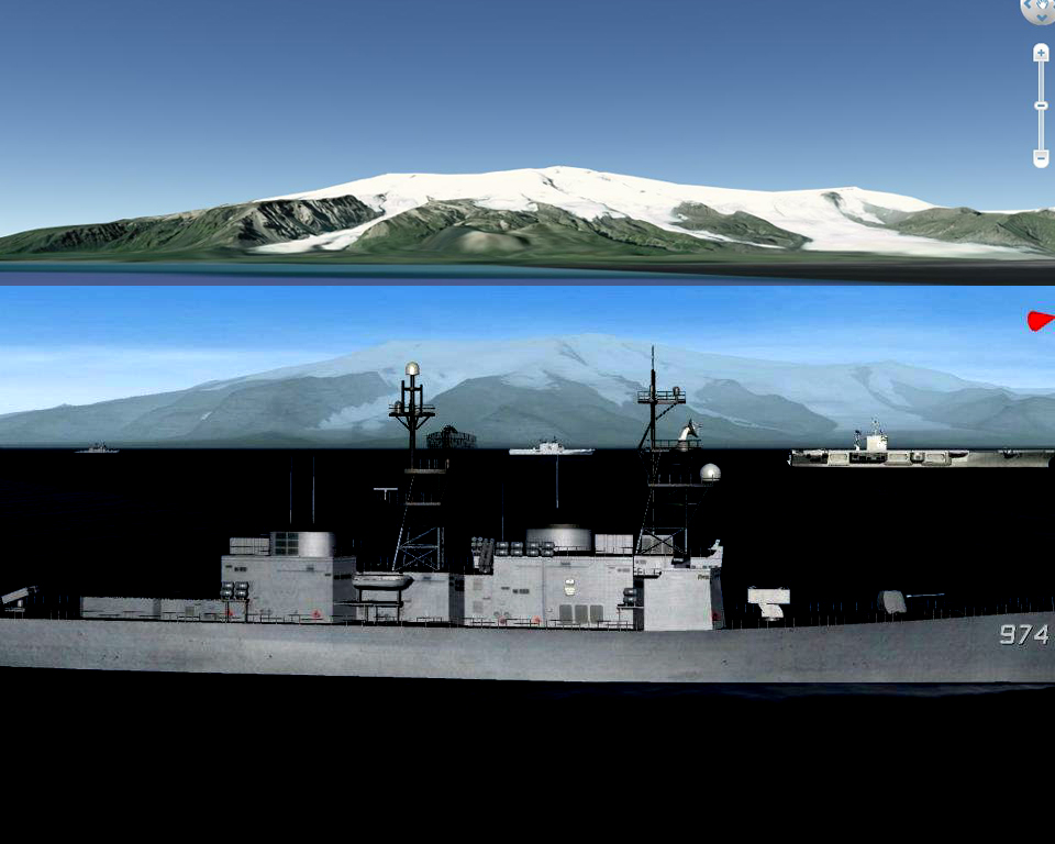
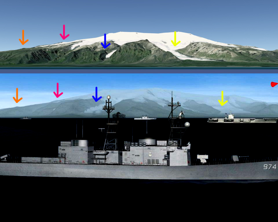
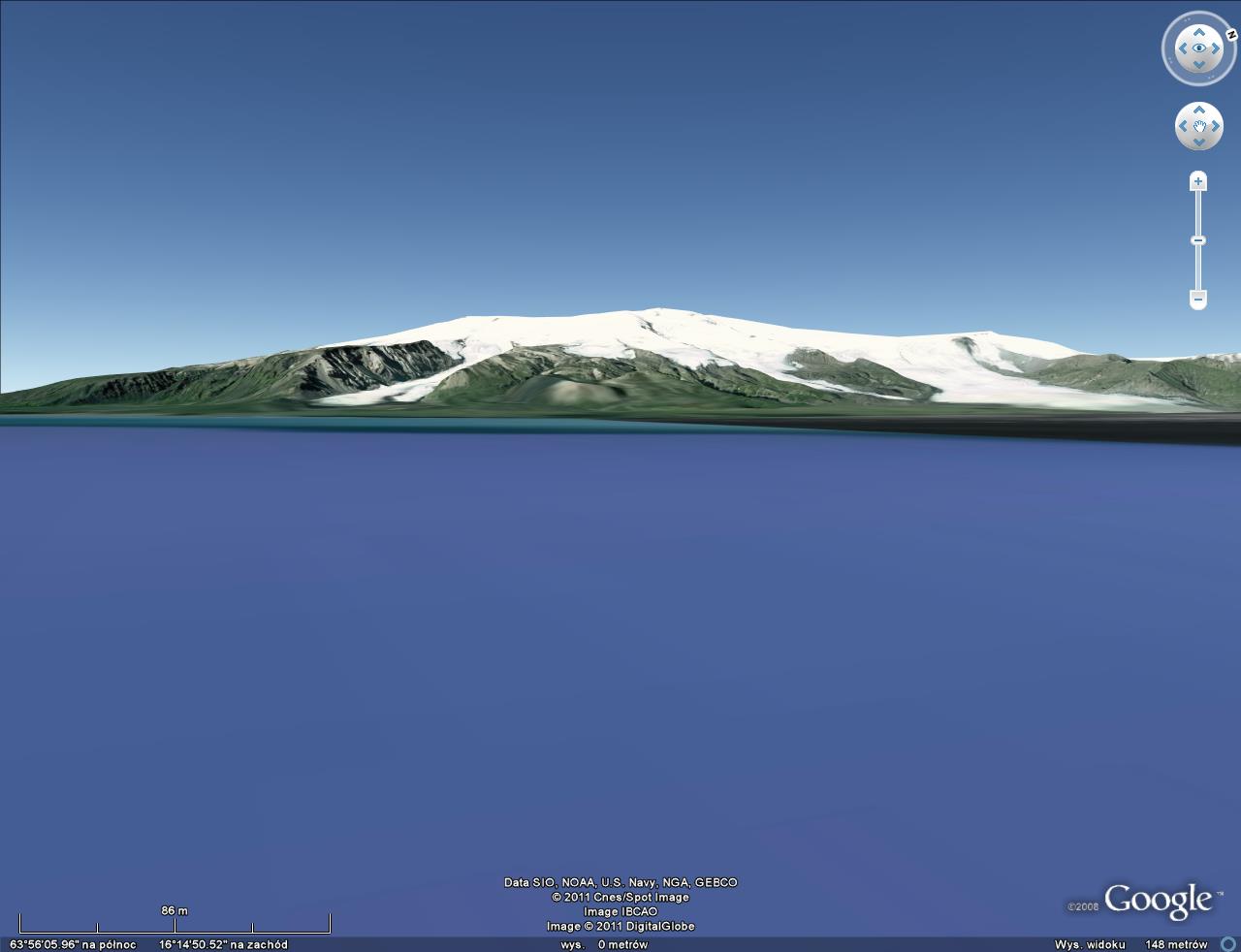
here's the better matching comparision of GoogleEarth 3D model with the best so far in-game terrain shot, to me the in game one looks very well done compared to GE data: notice the ice/glaciers borders on both shots, also heightmap in general, these look almost identical the viewpoint in GE is some 9-9.5 kilometers off shore to give you distances clue, the slight difference in height of the mountains is due to different FOV, I did my best to find similar spot in GE 3D world
-
I think there's good chance for multiple weapons systems for ships the lifeboats? No
-
I'm pretty sure answer is yes, Iceland being testbed for new renderer/data pipeline
-
3D Studio was mentioned on several occasions
-
Ed your words page back
-
interesting... my quick Google Earth analysis: given I made slight mistake in localization (screenshot POV seems more to the East) looks good
-
Moddable LOMAC
-
makes a lot of difference, ain't? also the terran given it's far away from the TF, seems to have much higher heightmap resolution
-
new SF2NA screens makes my blood pressure going nuts ;)
-
why? it is flat, like 99% other sims
-
-
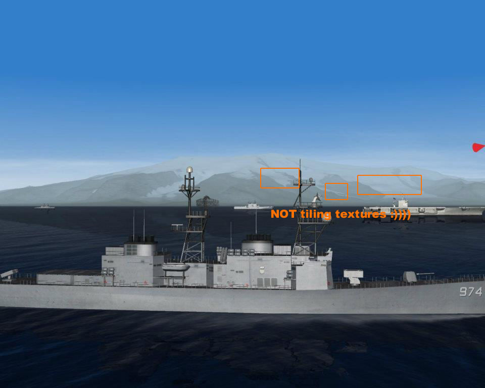
terrain looks new/better
-
we're soo doomed now
-
but it doesn't differ from first one right? Gav up HAWX after first two or three missions (that is on second approach to it)