Search the Community
Showing results for tags 'map'.
Found 10 results
-

Il2 DD Update Dev Blog 319 "Normandie, D-Day"
76.IAP-Blackbird posted a topic in IL-2 Series / Pacific Fighters / Cliffs of Dover: News
Dear Pilots! In today’s DD we have three new things to show you. First, we have some screenshots of our Normandy Map which is coming together nicely. It’s looking very scenic! Second, we have developed the technology to launch a V-1 “Buzz Bomb” from fixed installations. They will make great targets for mission designers. And finally, we have been working on the technology necessary to portray amphibious landings which is necessary for Normandy. Normandy Landscape Below are screens from the new map. As you can see there are some rather large cities and towns as well as a variety of different airfield types. The landscape is also very beautiful. Together it will make a very interesting and fun map to fly over. V-1 Installations The dreaded V-1 is operational in our project for the first time. V-1 sites were prized targets by Allied pilots and needed to be silenced. The V-1s raining down on the UK in the summer of 1944 were a real problem and caused so much destruction and casualties. Attacking these sites will make for some excellent missions. Amphibious Landings And finally, we can’t have an invasion without landing craft bringing troops and vehicles to the beaches. In the images below we see some testing on one of our non-Normandy maps. We have found a clever way to make infantry objects that appear pretty convincing. These soldiers can advance and shoot at the enemy and of course they can perish. Just don’t ask these little pixel soldiers to make you a sandwich or tea, they aren’t that smart. Enjoy! The Sturmovik Team- 1 reply
-
- 3
-

-
- 777 studios
- 1944
- (and 9 more)
-

Planning Map Unit Icons
Righteous26 posted a topic in Thirdwire: Strike Fighters 2 Series - General Discussion
Does the game limit you to the four basic icons for friendly and enemy aircraft and ground units or can a specific unit (e.g. 1st Tank Brigade) have its own icon assigned? I made some icons for Dhimar and Paran with the basic names and included them below. Should you wish to use them just copy them to your mod folder /Menu folder and overwrite if asked. ENEMYAIRCRAFTICON.bmp ENEMYGROUNDFORCEICON.BMP FRIENDLYAIRCRAFTICON.bmp FRIENDLYGROUNDFORCEICON.BMP -

SF2 TERRAIN - NOT WORKING
Avrillav posted a topic in Thirdwire: Strike Fighters 2 Series - General Discussion
Hello. I have just reinstalled the SF2 and put all addons I have already used. It is all working. However, after I downloaded new terrains (Iraq03 and Libya), my SF2 cannot recognize these maps in Mission Map sections. However, other maps I have used before work. What is the solution, please?- 14 replies
-
- iraq
- mission map
- (and 4 more)
-

Open Atlantic terrain HFD
Gepard posted a topic in Thirdwire: Strike Fighters 2 Series - File Announcements
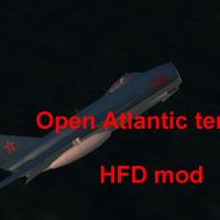
File Name: Open Atlantic terrain HFD File Submitter: Gepard File Submitted: 23 March 2014 File Category: Full Terrains Open AtlanticTerrain HFD v.1.1 ***************************************************** This terrain is written for SF2NA +++++++++++++++++++++++++++++++++++++++++ I. Short description: The terrain covers the open Atlantic Ocean south of Iceland. It is a mod of the Open Ocean Carrier Battle Map terrain. It is made for slower computers, thatswhy it use no LOD based terrain, but the old HFD. Changes to previous version: - starting positions of the carriers are variable now - 2 more recon points - changed the sides on the map. Soviets starts west, NATO starts east (to simulate a carrier duell NW of Scottland) ++++++++++++++++++++++++++++++++++++++++++++++++ II. INSTALLATION: Unzip all files into your Wings StrikeFighters2 /terrain folder. Thats it. ++++++++++++++++++++++++++++++++++++++++++++++++++ III. Credits. I want to say thank you to JonathanRL who made the original Open Ocean Carrier Battle Map ++++++++++++++++++++++++++++++++++++++++++++++++ IV. This Terrain is Freeware. Commercial use is not allowed. +++++++++++++++++++++++++++++++++++++++++++++++++ V. For remarks, comments, bugs, etc please use CombatAce forum or send me a PM. Hope you enjoy it. Michael (Gepard) Made in Germany 02 June 2014 Click here to download this file- 1 reply
-
- 1
-

-
- carrier duell
- map
-
(and 1 more)
Tagged with:
-
Version 1.1
432 downloads
Open AtlanticTerrain HFD v.1.1 ***************************************************** This terrain is written for SF2NA +++++++++++++++++++++++++++++++++++++++++ I. Short description: The terrain covers the open Atlantic Ocean south of Iceland. It is a mod of the Open Ocean Carrier Battle Map terrain. It is made for slower computers, thatswhy it use no LOD based terrain, but the old HFD. Changes to previous version: - starting positions of the carriers are variable now - 2 more recon points - changed the sides on the map. Soviets starts west, NATO starts east (to simulate a carrier duell NW of Scottland) ++++++++++++++++++++++++++++++++++++++++++++++++ II. INSTALLATION: Unzip all files into your Wings StrikeFighters2 /terrain folder. Thats it. ++++++++++++++++++++++++++++++++++++++++++++++++++ III. Credits. I want to say thank you to JonathanRL who made the original Open Ocean Carrier Battle Map ++++++++++++++++++++++++++++++++++++++++++++++++ IV. This Terrain is Freeware. Commercial use is not allowed. +++++++++++++++++++++++++++++++++++++++++++++++++ V. For remarks, comments, bugs, etc please use CombatAce forum or send me a PM. Hope you enjoy it. Michael (Gepard) Made in Germany 02 June 2014- 2 comments
- 4 reviews
-
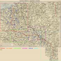
File Name: WOFF Westen Front Airfield Maps File Submitter: chrispdm1 File Submitted: 21 December 2013 File Category: Maps, Missions, and Campaigns This is the second version of my airfield mapping for Wings: Over Flanders Fields. Credit goes to Rabu for his Flanders map that he has allowed me to use to map airfields on. The Paris map was created entirely by myself. The others were public domain and the airfield data came from WOFF itself. Please do not repost or change and distribute without crediting rabu and myself. Click here to download this file
-
- over flanders fields
- world war 1
- (and 8 more)
-
Version 1.1
183 downloads
This is the second version of my airfield mapping for Wings: Over Flanders Fields. Credit goes to Rabu for his Flanders map that he has allowed me to use to map airfields on. The Paris map was created entirely by myself. The others were public domain and the airfield data came from WOFF itself. Please do not repost or change and distribute without crediting rabu and myself.- 1 review
-
- wings over flanders fields
- off
- (and 8 more)
-
Soo... I am working on the TMF Mirage F.1 and for some reason max would not open the texture files / show them in the original files so I had to make a blank scene and import the model by the merge function and redo the materials. Now, for some reason, the material glitches occasionally very badly, like so: This mostly occurs when there are effects present like flak bursts or afterburner. Is there some problem with my 3ds max materials?
-
File Name: Lothar Maps File Submitter: Lothar of the Hill People File Submitted: 03 December 2012 File Category: Maps, Missions, and Campaigns This mod offers several alternative in-game maps for Over Flanders Fields based on modern Google imaging: Lothar Google Map – Google’s Terrain map illustrating basic topography with modern cities and roads, much of which hasn’t changed from a map-eye view over the past century. While there’s a hint of the underlying topography, this is generally best for flying by human landmarks. Lothar Google Earth – Google Earth satellite imagery was a long way from even hypothetical during the Great War, so this mod applies diffusion and texture filters for a slight painted canvas map effect. Important locations are marked as on the stock OFF map, but overall this is best for just flying by terrain. Lothar Google Mix – This simply overlays the two above maps with transparency. Things may not line up exactly, especially at the extremes of the map, but overall this provides a subtler view of the road and city detail of the Google Map with more of the geographical richness of the satellite view. In any case, the result is vastly more detailed, accurate, and useful than the stock OFF map, despite the occasional anachronism. Try them all to see which you prefer on utilitarian and aesthetic merits. And have fun exploring with fresh eyes the amazing terrain Over Flanders Fields and beyond! Requires: Over Flanders Fields http://overflandersfields.com JoneSoft Generic Mod Enabler 2.6.0: http://combatace.com/files/file/13045-jonesoft-generic-mod-enabler-jsgme/ Installation and Usage: The installer automatically extracts the mod folders into your OFF JSGME mods folder if OFF and JSGME are installed correctly. JSGME will be run when installation is complete, just activate the ‘Lothar Google Map’ or ‘Lothar Google Earth’ or ‘Lothar Google Mix’ folder to enable the mod. It only makes sense to activate one of the map mods at a time, but you can easily switch between them with JSGME. Notes: The front no longer displays in the Briefing Room, but does so (and more accurately) on the in-flight map. Credits: http://combatace.com/user/48442-lothar-of-the-hill-people/ Click here to download this file
-
Version 1.0
132 downloads
This mod offers several alternative in-game maps for Over Flanders Fields based on modern Google imaging: Lothar Google Map – Google’s Terrain map illustrating basic topography with modern cities and roads, much of which hasn’t changed from a map-eye view over the past century. While there’s a hint of the underlying topography, this is generally best for flying by human landmarks. Lothar Google Earth – Google Earth satellite imagery was a long way from even hypothetical during the Great War, so this mod applies diffusion and texture filters for a slight painted canvas map effect. Important locations are marked as on the stock OFF map, but overall this is best for just flying by terrain. Lothar Google Mix – This simply overlays the two above maps with transparency. Things may not line up exactly, especially at the extremes of the map, but overall this provides a subtler view of the road and city detail of the Google Map with more of the geographical richness of the satellite view. In any case, the result is vastly more detailed, accurate, and useful than the stock OFF map, despite the occasional anachronism. Try them all to see which you prefer on utilitarian and aesthetic merits. And have fun exploring with fresh eyes the amazing terrain Over Flanders Fields and beyond! Requires: Over Flanders Fields http://overflandersfields.com JoneSoft Generic Mod Enabler 2.6.0: http://combatace.com/files/file/13045-jonesoft-generic-mod-enabler-jsgme/ Installation and Usage: The installer automatically extracts the mod folders into your OFF JSGME mods folder if OFF and JSGME are installed correctly. JSGME will be run when installation is complete, just activate the ‘Lothar Google Map’ or ‘Lothar Google Earth’ or ‘Lothar Google Mix’ folder to enable the mod. It only makes sense to activate one of the map mods at a time, but you can easily switch between them with JSGME. Notes: The front no longer displays in the Briefing Room, but does so (and more accurately) on the in-flight map. Credits: http://combatace.com/user/48442-lothar-of-the-hill-people/


