

Stary
-
Posts
8,500 -
Joined
-
Last visited
-
Days Won
100
Content Type
Profiles
Forums
Gallery
Downloads
Store
Everything posted by Stary
-
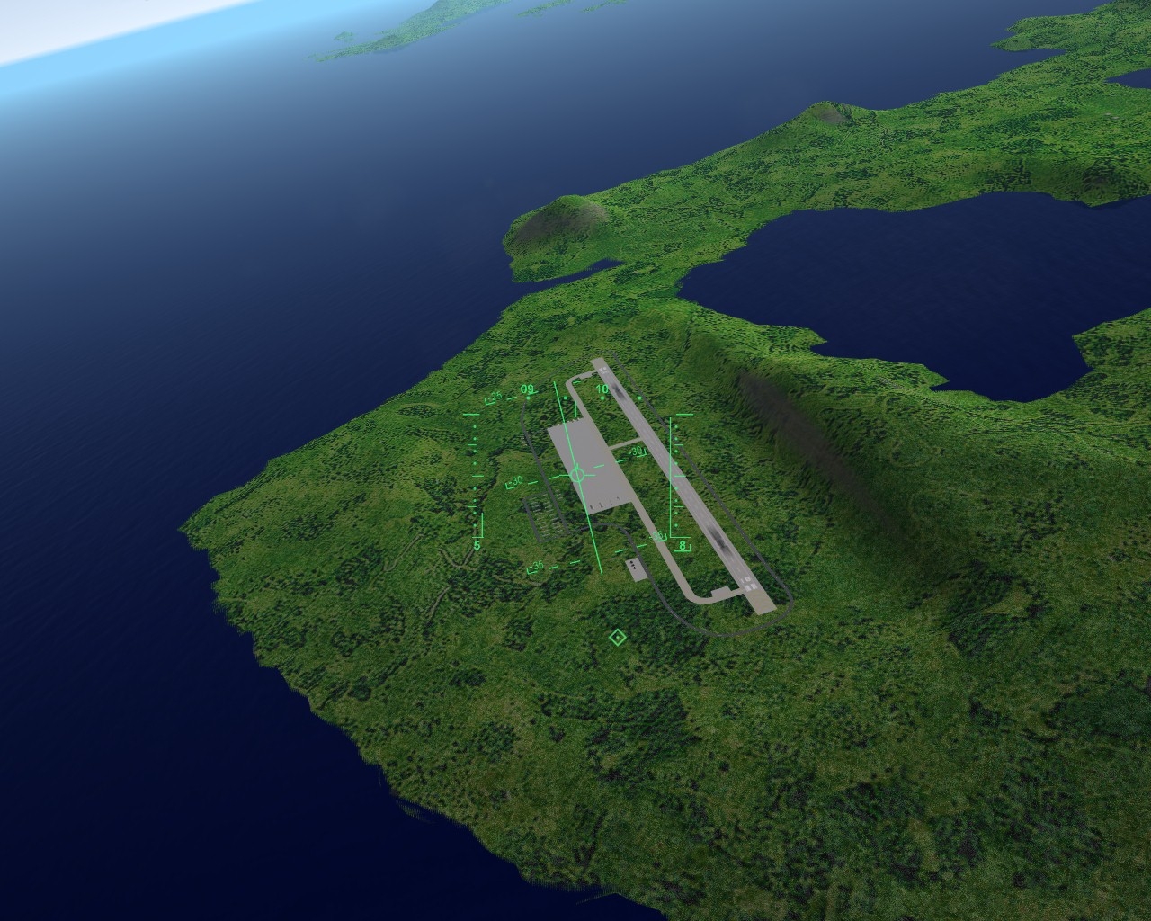
most awesome screens Dave have some souvenir for your naval operations testing pending approval
-

Version 1.0
309 downloads
FOR SF2:North Atlantic ONLY! This is simple open waters map, for testing purposes. Whole map consists only of single 100x100 kilometers plane, repeating self to create 1000x1000 kilometers map. Water file is defined, so are locations of Friendy and Enemy task forces spawn points. I decided NOT to include any test islands so far to keep it clean of any land areas. For testing/evaluation purposes ONLY I've included simple Max files used to created this terrain, one is 1000x1000 KM mesh, the other, used in this map is 100x100 KM on -
maybe the guy has his own inhouse tools he keeps for whatever reason for himself
-
my error during tests -exported as [DefaultMesh] which is on naval maps water, and thus repeats self all over the map, so the mesh of terrain was repeating over and over giving the 60 million polys (and one frame per 3 seconds...) max mesh I exported was much smaller of course
-
it works, the colors, did this myself in test terrain, it's quite simple actually
-
we don't need uber realistic avionics after all, but one suggestion: new terrain engine could be a nice addition... ohhh crap!
-
I like it!
-
Just in time as I was wondering about the status Dave and I'm all for some artistic license for fun factor, this ain't DCS after all
-
I tried that Gepard, adding LOD meshes to terrain but the new way, doesn't compute funny as the more time I spend with the new terrain engine the more I think old one is better and user friendly in many areas... imported small 300x300 km part of Vietnam map, ended with 60 MILLION polys Gerwin, keep it up!
-

NVidia driver update and now no screenshots anymore!
Stary replied to Kodiak's topic in General Discussion
hmmm, I had to live with that in my case -
man I must start adding stuff to my NA install, with that JSF's LHA working and other planes...
-
works as reverse gears or something?
-
NVidia driver update and now no screenshots anymore!
Stary replied to Kodiak's topic in General Discussion
Kodiak, used to happen in my case months ago, it's not the drivers, it's the heavily modded install with alot of textures and models causing that -
mmm, refueling hose, right?
-
this was a good one
-
what's that exhaust nozzle-like thing underneath? edit: connection issues, double post
-
nope, the new engine works differently
-
only if built into the terrain mesh, so for Iceland, none I guess
-
let me do quick search for a Midwest fail one watch out, Monday morning, not in mood (until coffe will imporve that) j/k
-
oh yes, sorry, haven't noticed your post earlier Russo, yes the not-needed entry from my experiments for bombsight, remove the class again, apologies for not peeking here earlier
-
I'm not 100% sure now Monty, but there is such possibility. But I repeat -I;m sure there are other methods we don't know yet, hidden in the locked away parts of IcelandNA.CAT
-
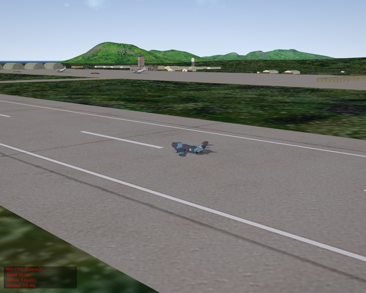
game accounts your virtual pilot's wounds that may lead to his death after the mission re spoiler: that's the way particlesystem works, every time you switch to the model that has (my in ths case) smoke effect, restarts the particle emitters, annoying I know @Heberth: mmm, ok, got me there... new Raptor model or what? SZ, Vampire -great shots!
-
I'm not sure how the engine would handle such meshes, the ones without any prefix defined edit: the engine doesn't see them as ground I think, for example objects placed on them would "sink" to zero level I guess, here's l_ prefix mesh with objects ontop, works: can't say exactly, I did soo many versions today searching for something that actually works
-
I guess yes, but so far in my limited progress on the terrain format, the meshes without prefixes haave no collision calculations as for limited shader autotexturing... I'm pretty sure we don't know the full list of shaders, please remember our guesses are based entirely on unlocked ini references, mainly IcelandNA_data.ini, I bet there are some other shaders and variables already implemented but not used by the Iceland data file
-
nope, you'd kill any computer this way, autogen is the way to go