


About This File
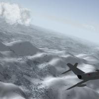
Kamchatka Peninsula 250m heightmesh update with corresponding tweaks and rejuvenated/extended tileset and layout
for Strike Fighters 2, best fully-merged installation
v1.0
by Stary
July 2016
^^^^----------------------------------------------^^^^
This is test rebuild of Baltika's and Wrench's Kamchatka terrain, based on Kamchatka v2.0 which is major update to original Baltika's
terrain by Wrench.
This is semi-experimental update aimed at demonstrating and testing in wider userbase usage of denser resolution heightmesh.
I can >>not<< guarantee the stability of this terrain due to engine limitations and what I observed and what seems to be slight memory handling issues of the SF2 engine
Credits:
Baltika and Wrench for their work on Kamchatka map.
Gerwin for TFD tool and BMP2TFD
Combatace and Thirdwire
All the nice people around here
Extended information, please read carefully!
The height mesh:
The stock Thirdwire .hfd terrain format uses publictly available DEM (digital elevation model) databases to produce 500 meters vertex
spaced terrain meshes with 2000 meters tiles covering them. This is proven, easy to use system but 500 meters is awfully 1999 technology
for 2016 systems. Thus given my efforts into NA LOD-based terrains creation stalled due to lack of knowledge and tools I decided to
reproduce one of more interesting yet obscure maps available, the Kamchatka Peninsula.
The mesh in this download currently uses 250 meters resolution which is twice the density and detail* compared to original terrain.
Please note that due to being based on low resolution hfd file output the actual height representation is somewhat off compared to real terrain!
Not much and not that it really matters much. "If it looks good it is good"
New heightmap was created in several steps which I now describe to help other more advanced terrain modders possibly use this method:
First steps -Gerwin's TFDTool and Photoshop:
-I used Gerwin's TDF tool to output the heightmap via F9 key
-Also created the textures bitmap as a helper file via F7 key
-The created file in grayscale is 3000x3000, which corresponds to 500m resolution on 1500000m map (3000/2=1500! Magic!)
-Thus I rescaled the file to 6000x6000 pixels, the same with the texture bitmap which I copied to greyscale file for reference
-The 6000x6000 or twice the original is the 250m per pixed heightfield file
-I filled the blue water areas TFDTool creates with pure black 0,0,0
-Then I spent some time in Photoshop working on several layers and using several brushes and tools to slightly tweak the grayscale height
image, mostly to brighten the higher areas and adjust some more interesting places. Mostly blur, stroke tools and some slight wave-y
filers to add some detail to now ARTIFICIALLY pumped up resolution (further on this below)
-Pro tip: to get rid of any water/shore artifacts is easy way, the so called tsunami waves or coast areas on slopes I selected the
texture map layer, selected all water areas (select by pixel color) and created another pure black layer on top of the main height layer,
that drops slight shadows around it (2 to 4 pixels black shadow) -this way the heightmap gets toned down for few pixels (two is good
value) when near the water areas; think smart not hard as The Ancient One says :P
when the heightmap was considered ready I flattened it and converted to 8bit palleted file using the stock Thirdwire terrain editor
palette (you can do this palette by exporting any heightmap as bitmap from within the TE and saving it's palette to file, most programs
allow palette saving)
Second step -Thirdwire Terrain Editor, the 042106 version:
so now I had the TE-format palleted 8bit heightmap but to import it without further data loss I needed to adjust the TerrainEditor.ini
settings via notepad:
-the line that specifies the min-max scale of height present in the file is this line:
[bitmapImport]
HeightScale=15 <---- this line, by default uses value of 10
MinLandHeight=0 <---- by default 1
experimenting with this value gives you the similar results as using PGUP/PGDN keys when using Gerwin's bmp2tfd tool, basically sets the global vertical scaling of min-max values in file
To create new 250m resolution the values at creating new map are as follows:
Terrain Map Size: 1500 (km, like original Kamchatka terrain)
Texture Tile Resolution: 2000 (meters, like all common SF2 maps and tilesets)
Height Field Resolution: 250 (meters, compared to defaul 500 meters)
Then if you do have the texturelist loaded yo ushould get new flat terrain with textures filling the areas, just impor t he
heightmap from the created 6000x6000 paletted bitmap and save.
This is basic procedure, same can be used to create 125 meters resolution terrains (I did so for Korea3 terrain so far) BUT those are unstable and I am still trying to get
perfect values in BOTH flightengine.ini and given terrain's _data.ini
*now the heihgt information/detail gets lost every time we index the heightmap so one must then increase the HeightScale= value to get
more or less proper -OR GOOD LOOKING height values. Also be warned that Gerwin's TFDTool doesn't properly translate non-standard maps
(1000 kilometers ones go ok though) that is why the TE hassle
That said -the height scale is a bit OFF in this map so if you are a purist complain all you want, I wanted better looking mesh more than
geographical accuracy. To have the latter we need to come up with otehr height data sources for denser terrains. I have yet to look into
the tools and programs I own what could be of use.
Installation:
Before installing this mod BACKUP your Kamchatka terrain!!! There is possibility you won't get this terrain working at all so I warned
you!
To install this exctract the zip and move the content of the included folder to your Kamchatka terrain, overwrite when asked.
This way now you have new terrain tfd and hfd files, new inis, TODs and new reworked tileset in both summer nad winter flavours in their respective folders.
The mod has all the nedded tweaks into kamchatka.ini and kamchatka_data.ini already present,
HOWEVER to use this terrain in efficient way (ie, not to experience CTDs when loading the map every signle time) please do adjust few
things in your installation:
The essential is making small adjustments to your flightengine.ini file
[backgroundSceneClip]
FarClipDistance=70000
by default uses value of 80000, and while I now use the original value to prevent possible memory crashes use the 70000 value which lowers the loaded terrain "bubble" around the camera.
Also if you do use very extended trees/objects drawing distances (with or without additions of Mue's extra distance fading shaders) I
recommend lowering the DetailMeshSize= values, start with something like 8 or 10 and try if the map loads for you, can then increase this
further, it might be very VERY system-dependent
Known Bugs:
YES this is test and YES you might get constant CTDs when loading missions; might be very computer or installation dependent. I have
medium-high system and work ok with the values I use in inis. Also can't guarantee if some crazy large scale missions wouldn't prevernt the
terrain OR textures to load, as I have hit some engine limitations during more brutal force tests. That is why the tileset, albeit I have
it in 1024px resolution too, is 512 version.
Also you should have much less of issues when using ObjectsFade=TRUE and not using Mue's extender draw distance shaders. That is because
the sim engine apparently does not have to load ALL the TODs at once during mission loading, just later when need be.
Anyway that is my assumption, I might be totally wrong
Legal stuff:
CA Fair Use license apply, not to be used as base or part of any sort of payware
That should be all,
have fun (I hope) and if you are terrain modder, try my method. Again, 500m res is soo 1999 :P
Stary
What's New in Version 1.0
Released
- initial test release