Gepard
-
Posts
7,057 -
Joined
-
Last visited
-
Days Won
360
Content Type
Profiles
Forums
Gallery
Downloads
Store
Everything posted by Gepard
-
Since my older tiles for the London City Port not really fit into the terrain tileset i decided to restart and make them new. The screenshots show the WIP. The runway is still to overpaint and some other things are to do, but i think, i'm on a better way.

- 279 replies
-
- 10
-

-
You ask for a small river to big river merge tile. I have tried to build one, but it looks ... shi.... Its better to make big rivers and small rivers. Big rivers in the polish terrain would be Weichsel / Wisla and Oder /Odra. All other rivers i would make as small rivers.
-
The file below has now included riverforks between big rivers and between big and small river. City on coast tiles are active now and can be used. For tile setting with TDF Tool it should work. I have started to lay some small river tiles in Königsberg area. Here you see how small rivers can "flow" through cities. Ostpreussen12042020.7z
-
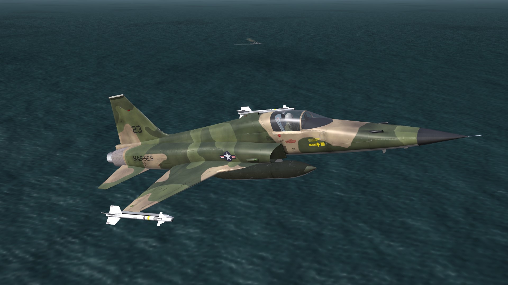
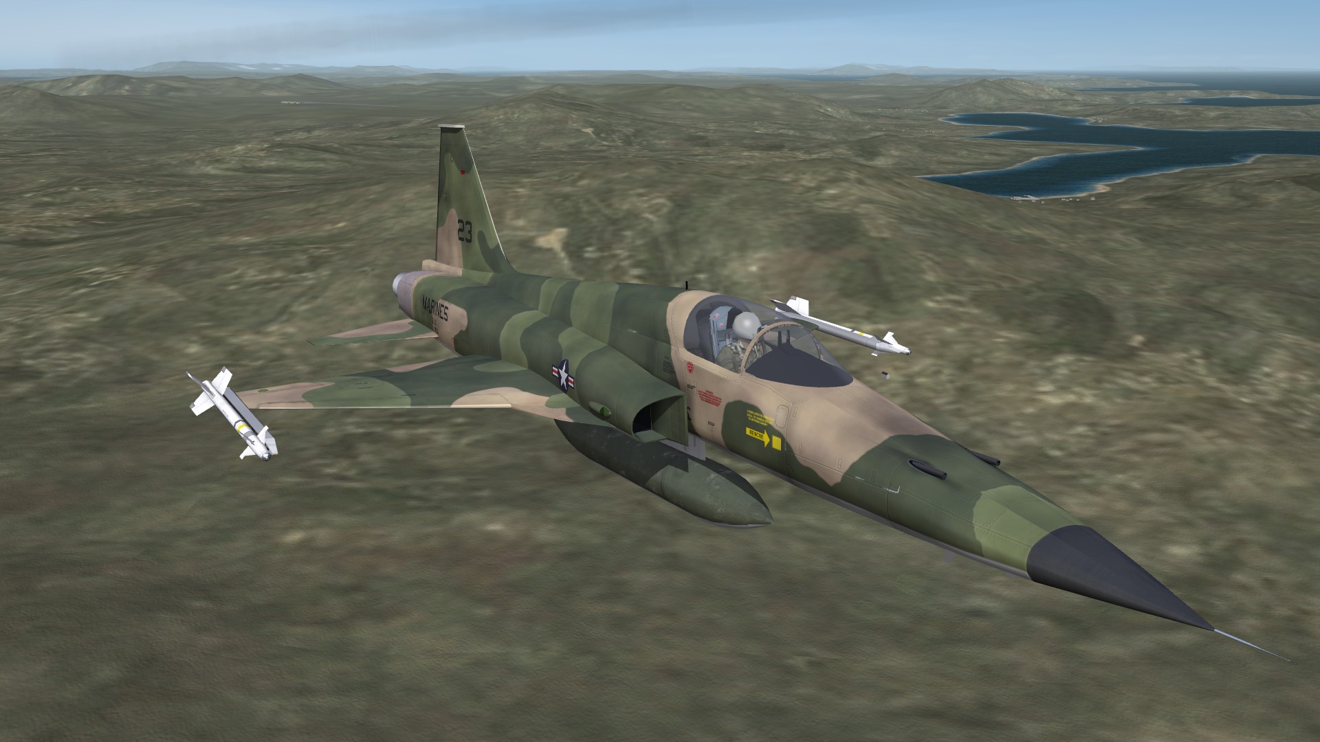
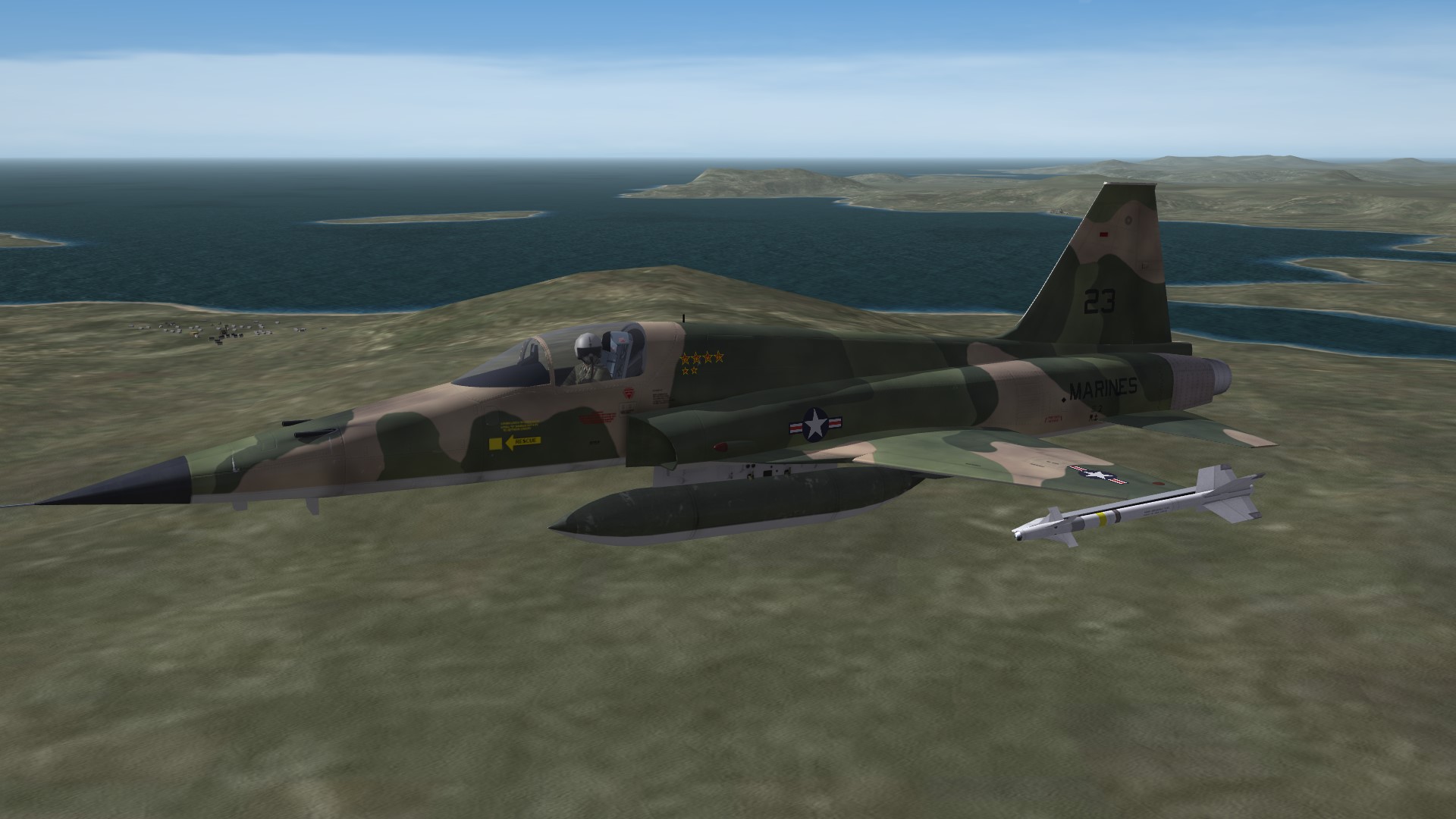
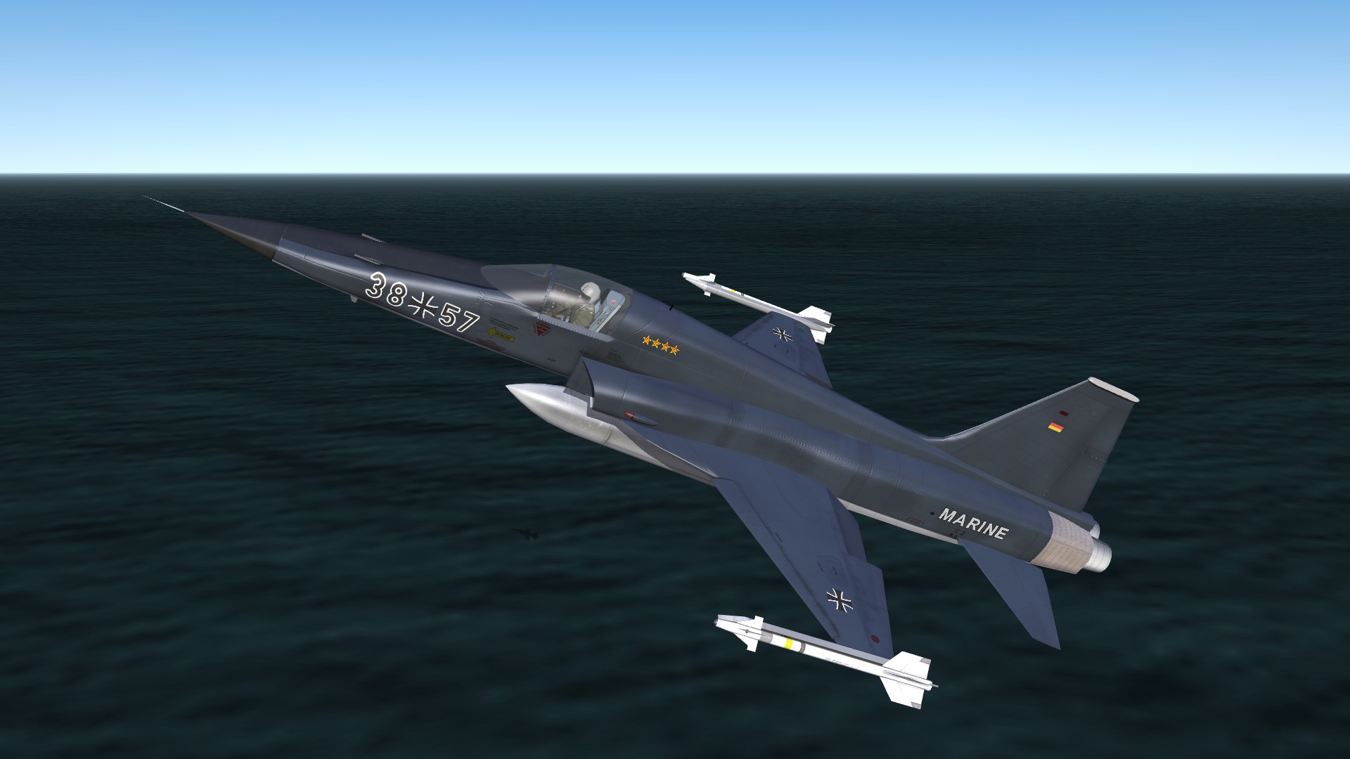
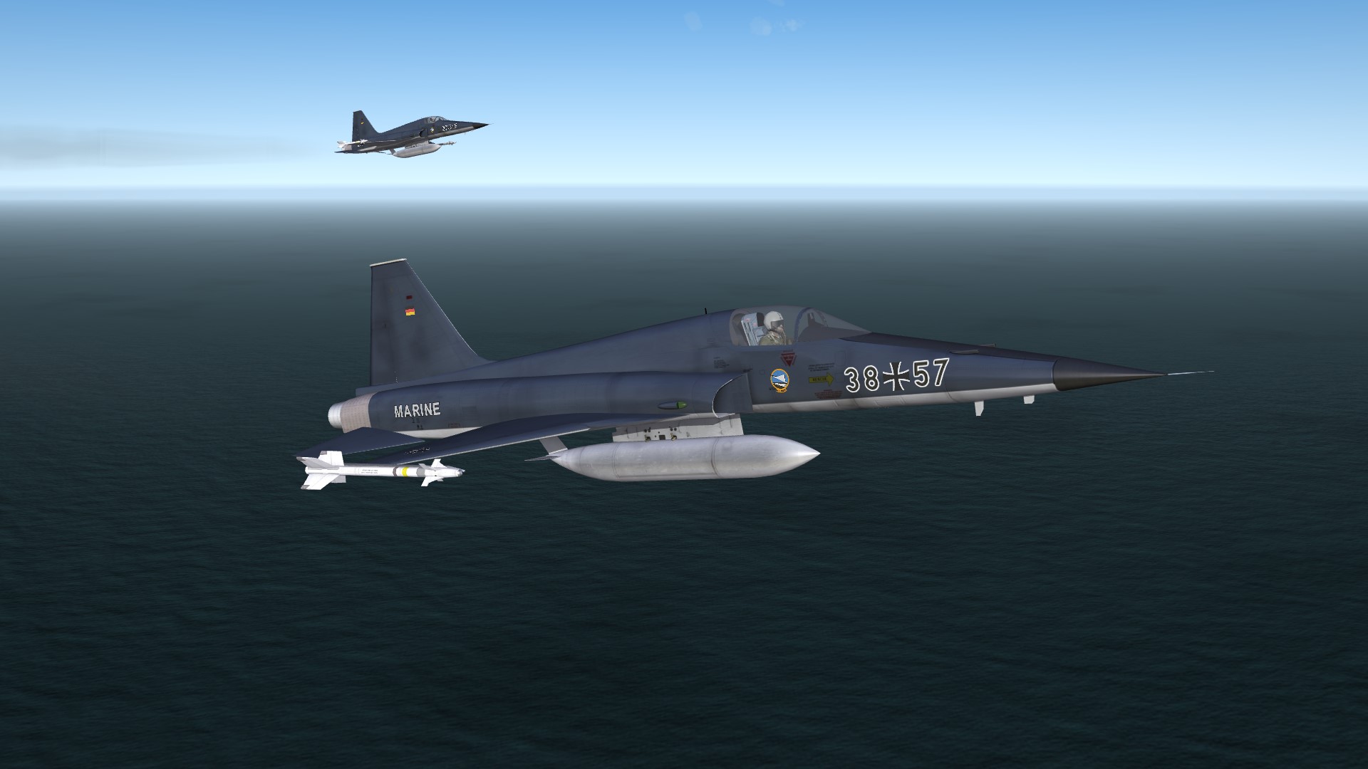
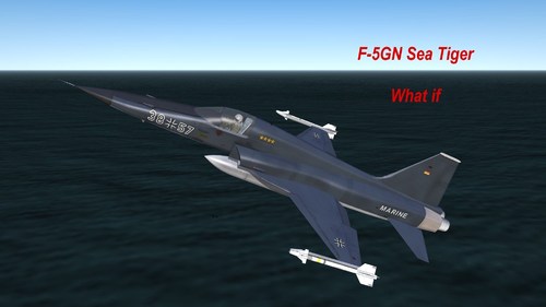
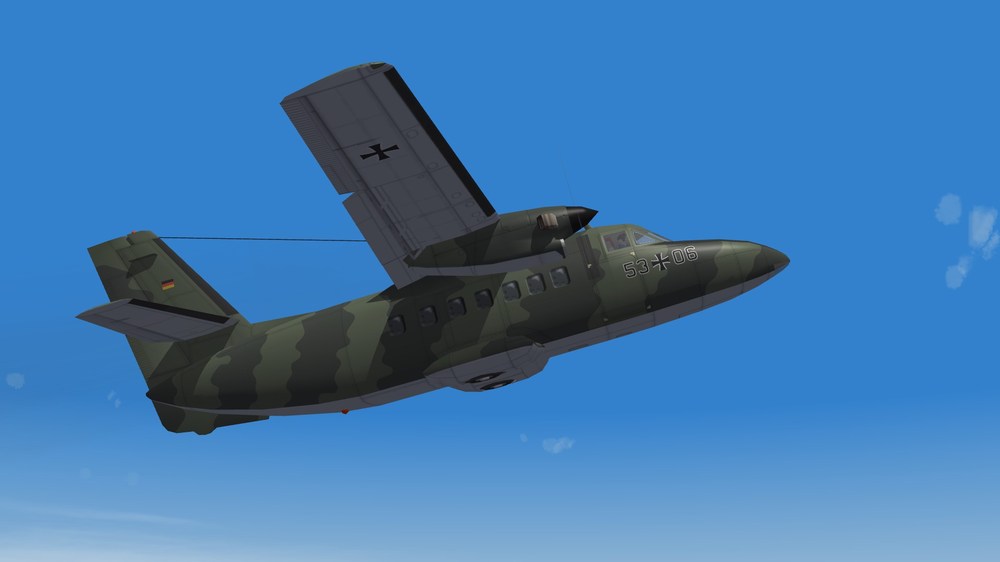
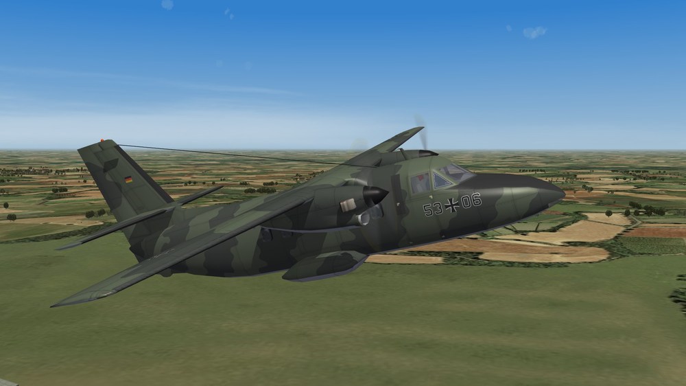
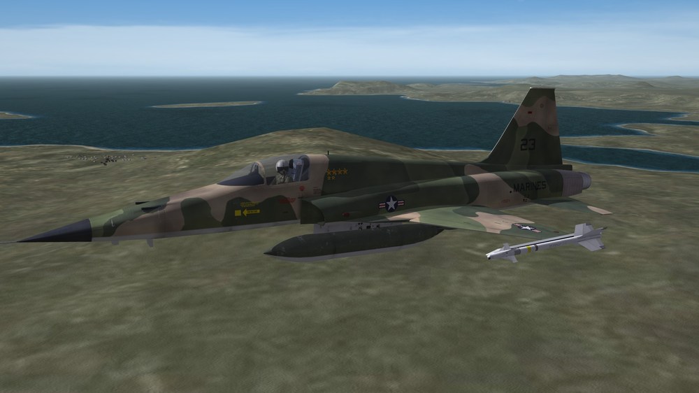
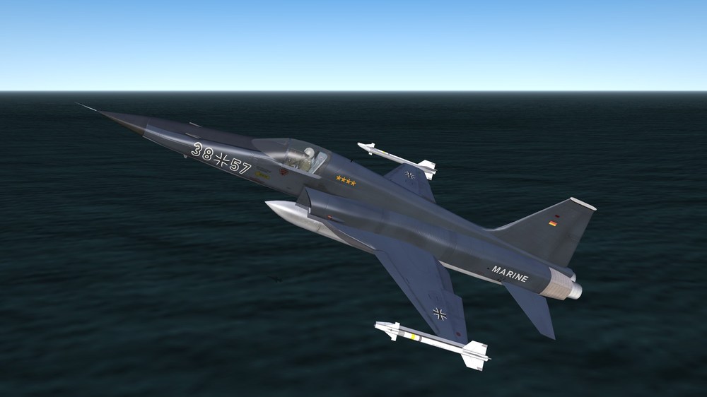
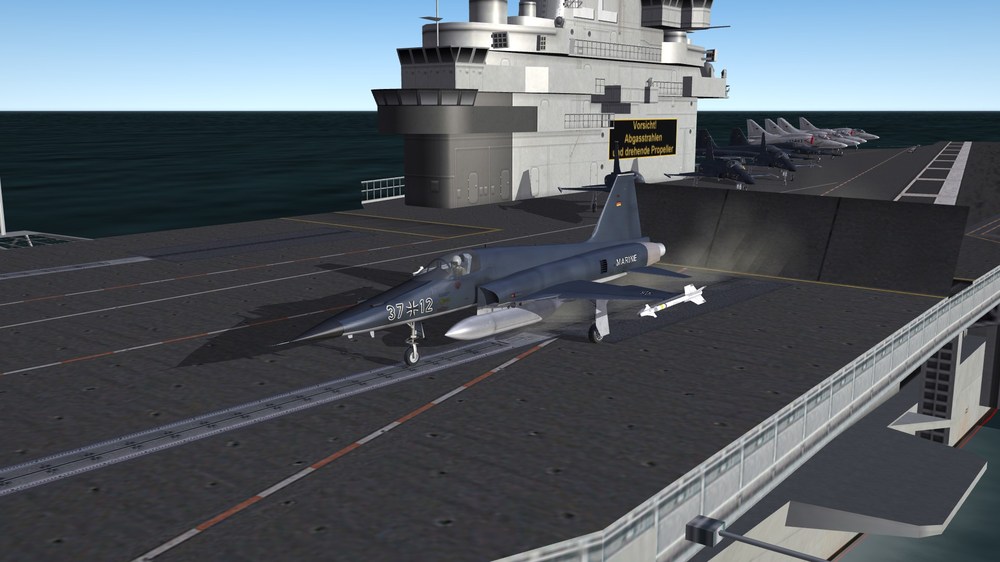
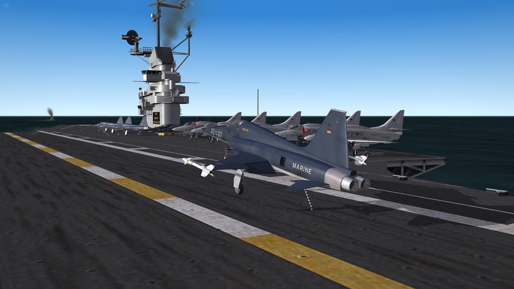
View File F-5GN F-5GN Sea Tiger (What if) ***************************************************** This mod is made for SF2. ---------------------------------------------------------- I. History (fiction) In 1969 there were decisive elections in West Germany. In reality, the Social Democrats won. A new foreign policy followed and a period of reduction of tensions between East and West. WHAT IF, the other side had won? What if the conservatives had won and Franz Joseph Strauß (an old bavarian Commie eater) would have become Chancellor of the Federal Republic of Germany? And so it starts. In 1969 Strauß was elected as Chancellor. A period of rising tensions between East and West started. To protect the sea lanes between Europe and America the west german parliament Bundestag decided to build up a west german carrier force consisting of 3 carriers. The american gouvernment was pleased and offered to sell 3 carriers of the Essex class (subclass Ticonderoga). The first ship which was handed over was CV-34 Oriskany in 1969. Renamed in R-22 Theodor Heuss it was core of the first west german carrier group. 1973 CV-38 Shangri-La became R-23 Heinrich Lübke (later renamed in Walter Scheel) and two years later CV-45 Valley Forge became R-24 Gustav Heinemann. The americans offered A-4 Skyhawk and F-8 Crusader as planes for the carrier group. The Bundesmarine accepted the A-4, but rejected the Crusader, because the Bundesmarine wanted a more multi role capable plane, not only a pure fighter. At this moment Northrop entered the competition and offered a navalised version of the brand new F-5E Tiger. Under the designation F-5GN (German Navy) it should be produced in America and Germany. The west german government accepted the offer and the serial production of the F-5GN started. During flight tests on the way the US Marines decided, that it would be a good idea to replace their old F-8 Crusaders with F-5GN planes. So the F-5GN became a Marine plane. Later, when the Marines retired their attack carriers the surviving F-5GN were transfered to Top Gun school. The F-5GN stayed in west german service till 1995. Then it was replaced by F-31 Mustang II. ----------------------------------------------------------------------- II. CREDITS: The F-5GN based on Centurions 2014 released F-5E package. A lot of files i have taken from this package. Thanks for this files! The skin: ~~~~~~~~~~~ The blue skin is a modification of a grey skin available in Centurions package The Marines skin is a mod of the Southvietnames skin available in Centurions Package The flight model : ~~~~~~~~~~~~~~~~ There are 2 flightmodels. One is a modified FM from package. I made the plane able to land on a carrier. The other FM i made by using parts of the stock F-16A FM made by TK. You find both FM in the folder "Goodies". You may change them as you want. ---------------------------------------------------------- III. INSTALLATION: -Unzip the folders into your SF2 mod folder ---------------------------------------------------------- IV. For remarks, comments, bugs, etc please use the forum or send me a PM. ------------------------------------------------------------- V. The F-5GN and all other files are FREEWARE. COMMERCIAL USE IS NOT ALLOWED! ------------------------------------------------------ ------------------------------------------------------------ Hope you enjoy it. Michael (Gepard) Made in Germany April 2020 Submitter Gepard Submitted 04/11/2020 Category F-5
-
- 4
-
-

-
- bundesmarine
- f-5
- (and 1 more)
-
Version 1.0.0
174 downloads
F-5GN Sea Tiger (What if) ***************************************************** This mod is made for SF2. ---------------------------------------------------------- I. History (fiction) In 1969 there were decisive elections in West Germany. In reality, the Social Democrats won. A new foreign policy followed and a period of reduction of tensions between East and West. WHAT IF, the other side had won? What if the conservatives had won and Franz Joseph Strauß (an old bavarian Commie eater) would have become Chancellor of the Federal Republic of Germany? And so it starts. In 1969 Strauß was elected as Chancellor. A period of rising tensions between East and West started. To protect the sea lanes between Europe and America the west german parliament Bundestag decided to build up a west german carrier force consisting of 3 carriers. The american gouvernment was pleased and offered to sell 3 carriers of the Essex class (subclass Ticonderoga). The first ship which was handed over was CV-34 Oriskany in 1969. Renamed in R-22 Theodor Heuss it was core of the first west german carrier group. 1973 CV-38 Shangri-La became R-23 Heinrich Lübke (later renamed in Walter Scheel) and two years later CV-45 Valley Forge became R-24 Gustav Heinemann. The americans offered A-4 Skyhawk and F-8 Crusader as planes for the carrier group. The Bundesmarine accepted the A-4, but rejected the Crusader, because the Bundesmarine wanted a more multi role capable plane, not only a pure fighter. At this moment Northrop entered the competition and offered a navalised version of the brand new F-5E Tiger. Under the designation F-5GN (German Navy) it should be produced in America and Germany. The west german government accepted the offer and the serial production of the F-5GN started. During flight tests on the way the US Marines decided, that it would be a good idea to replace their old F-8 Crusaders with F-5GN planes. So the F-5GN became a Marine plane. Later, when the Marines retired their attack carriers the surviving F-5GN were transfered to Top Gun school. The F-5GN stayed in west german service till 1995. Then it was replaced by F-31 Mustang II. ----------------------------------------------------------------------- II. CREDITS: The F-5GN based on Centurions 2014 released F-5E package. A lot of files i have taken from this package. Thanks for this files! The skin: ~~~~~~~~~~~ The blue skin is a modification of a grey skin available in Centurions package The Marines skin is a mod of the Southvietnames skin available in Centurions Package The flight model : ~~~~~~~~~~~~~~~~ There are 2 flightmodels. One is a modified FM from package. I made the plane able to land on a carrier. The other FM i made by using parts of the stock F-16A FM made by TK. You find both FM in the folder "Goodies". You may change them as you want. ---------------------------------------------------------- III. INSTALLATION: -Unzip the folders into your SF2 mod folder ---------------------------------------------------------- IV. For remarks, comments, bugs, etc please use the forum or send me a PM. ------------------------------------------------------------- V. The F-5GN and all other files are FREEWARE. COMMERCIAL USE IS NOT ALLOWED! ------------------------------------------------------ ------------------------------------------------------------ Hope you enjoy it. Michael (Gepard) Made in Germany April 2020- 1 review
-
- 3
-
-
-
- bundesmarine
- f-5
- (and 1 more)
-
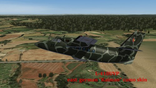
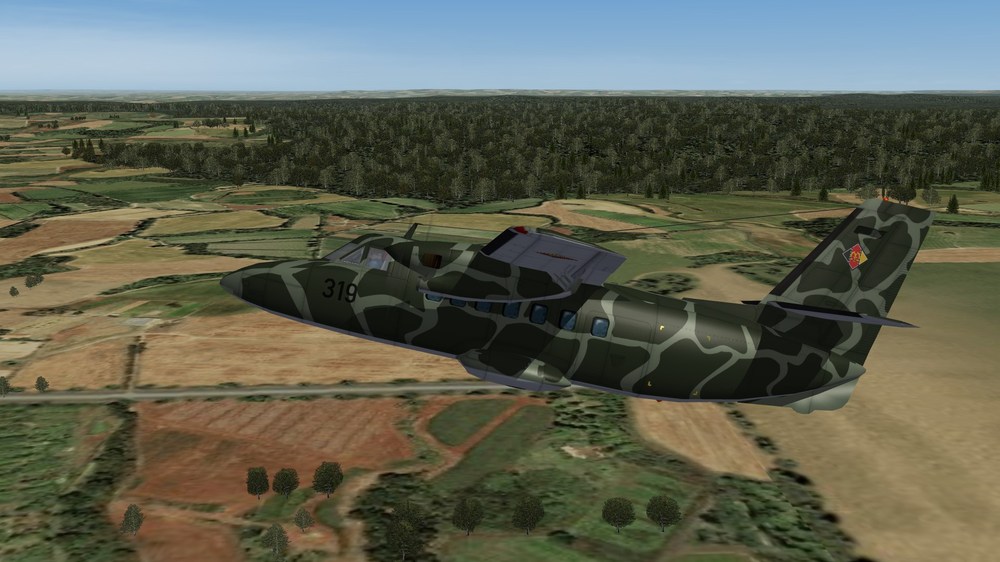
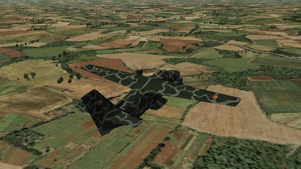
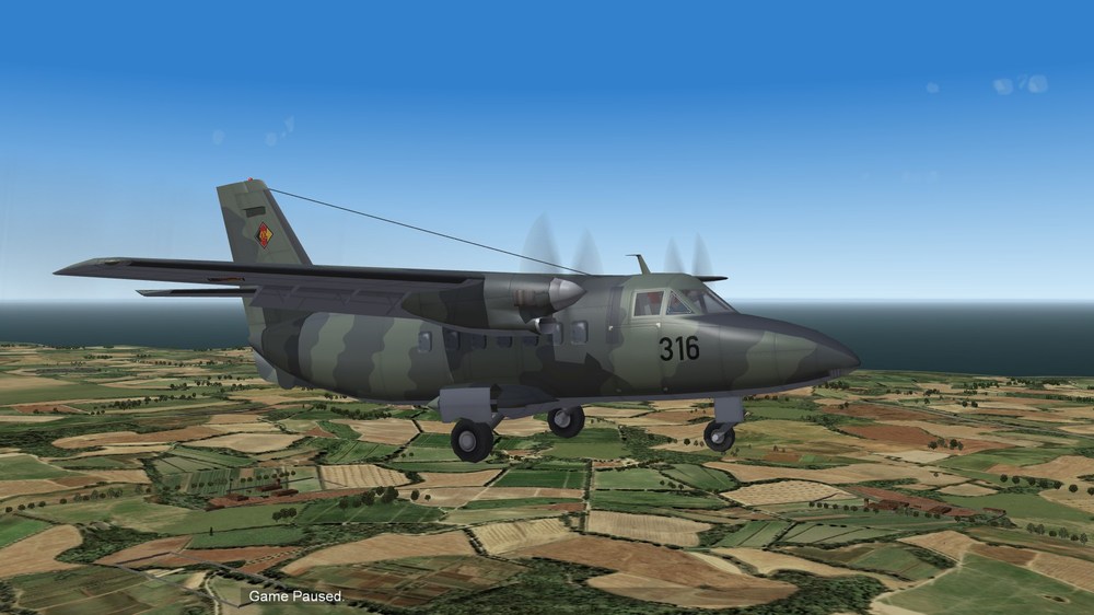
View File L-410UVP Kaiman camo skin This is the so called "Kaiman" camo skin, which one east german L-410UVP light passenger and transport plane had. L-410UVP-T Turbolet Kaiman skin ***************************************************** This mod is made for SF2. ---------------------------------------------------------- I. History The czech made L-410UVP light passenger and transport plane was developed to replace the old AN-2 biplanes. After a first version, called L-410A, the soviet Aeroflot airline demanded some changes, including better short take off capabilities. So the version L-410UVP was developed and widely exported in the COMECON states. The east german air force LSK, purchased 12 planes in 1980. They used it as training airplane for tranport pilots and navigators and for transport tasks. Parachute missions were made with the subversion L-410UVP-T (t- stands for Transport). VIP transport was made with subversion L-410UVP-S (s stands for Salon). Both versions were easy to discriminate. The T version had a black rubber plate behind the side door. ----------------------------------------------------------------------- II. CREDITS: The skin is: ~~~~~~~~~~~ made by me. The tactical numbers: ~~~~~~~~~~~~~~~~ are made by Paulopanz ---------------------------------------------------------- III. INSTALLATION: -Unzip the folders into your objects folder ---------------------------------------------------------- IV. For remarks, comments, bugs, etc please use the forum or send me a PM. ------------------------------------------------------------- V. The L-410UVP-T and all other files are FREEWARE. COMMERCIAL USE IS NOT ALLOWED! ------------------------------------------------------ ------------------------------------------------------------ Hope you enjoy it. Michael (Gepard) Made in Germany April 2020 Submitter Gepard Submitted 04/11/2020 Category Other Origin
-
- 2
-
-
-
- east german
- l-410
- (and 1 more)
-
Version 1.0.0
60 downloads
This is the so called "Kaiman" camo skin, which one east german L-410UVP light passenger and transport plane had. L-410UVP-T Turbolet Kaiman skin ***************************************************** This mod is made for SF2. ---------------------------------------------------------- I. History The czech made L-410UVP light passenger and transport plane was developed to replace the old AN-2 biplanes. After a first version, called L-410A, the soviet Aeroflot airline demanded some changes, including better short take off capabilities. So the version L-410UVP was developed and widely exported in the COMECON states. The east german air force LSK, purchased 12 planes in 1980. They used it as training airplane for tranport pilots and navigators and for transport tasks. Parachute missions were made with the subversion L-410UVP-T (t- stands for Transport). VIP transport was made with subversion L-410UVP-S (s stands for Salon). Both versions were easy to discriminate. The T version had a black rubber plate behind the side door. ----------------------------------------------------------------------- II. CREDITS: The skin is: ~~~~~~~~~~~ made by me. The tactical numbers: ~~~~~~~~~~~~~~~~ are made by Paulopanz ---------------------------------------------------------- III. INSTALLATION: -Unzip the folders into your objects folder ---------------------------------------------------------- IV. For remarks, comments, bugs, etc please use the forum or send me a PM. ------------------------------------------------------------- V. The L-410UVP-T and all other files are FREEWARE. COMMERCIAL USE IS NOT ALLOWED! ------------------------------------------------------ ------------------------------------------------------------ Hope you enjoy it. Michael (Gepard) Made in Germany April 2020- 4 comments
-
- 6
-
-
-
- east german
- l-410
- (and 1 more)
-
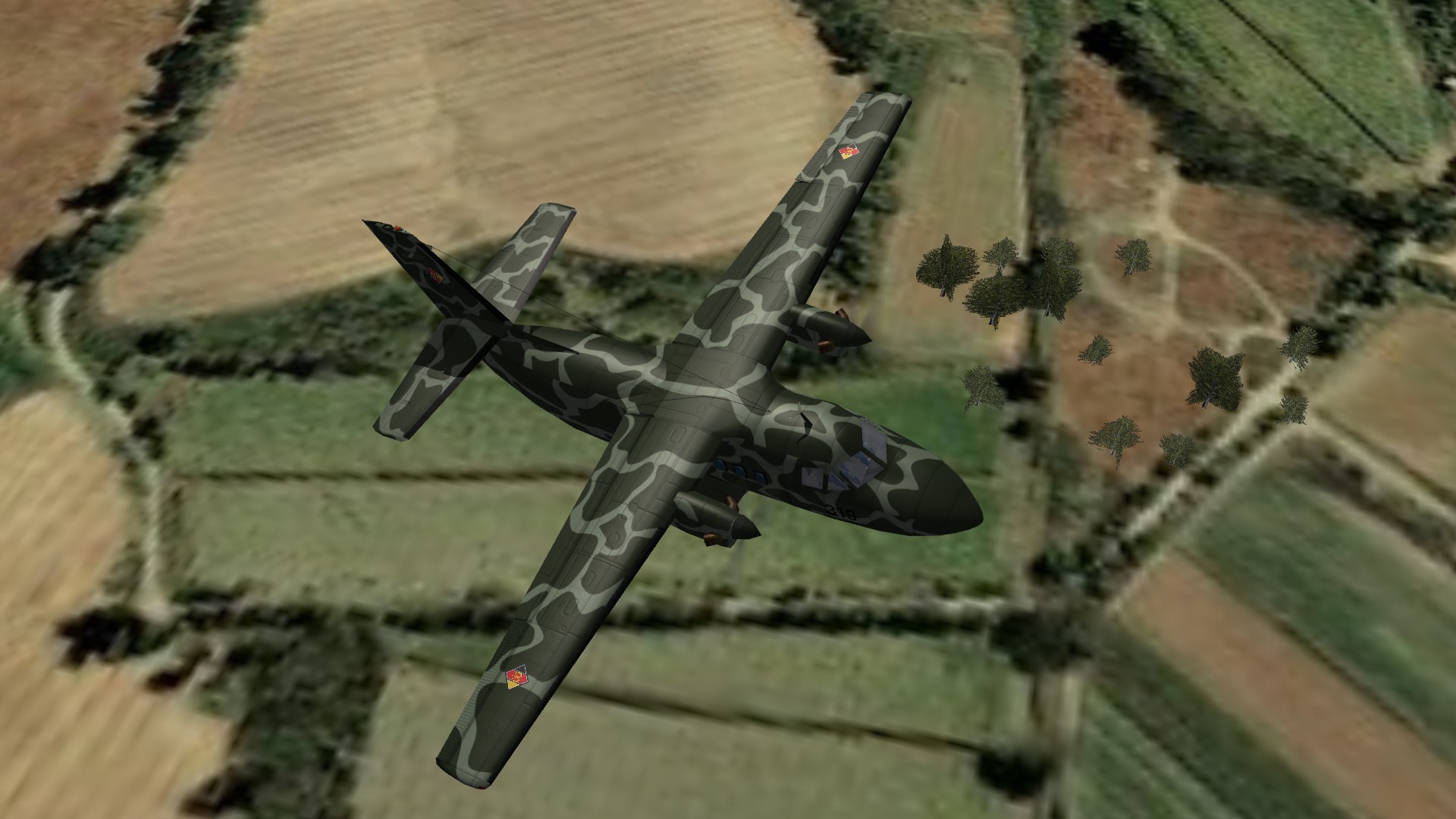
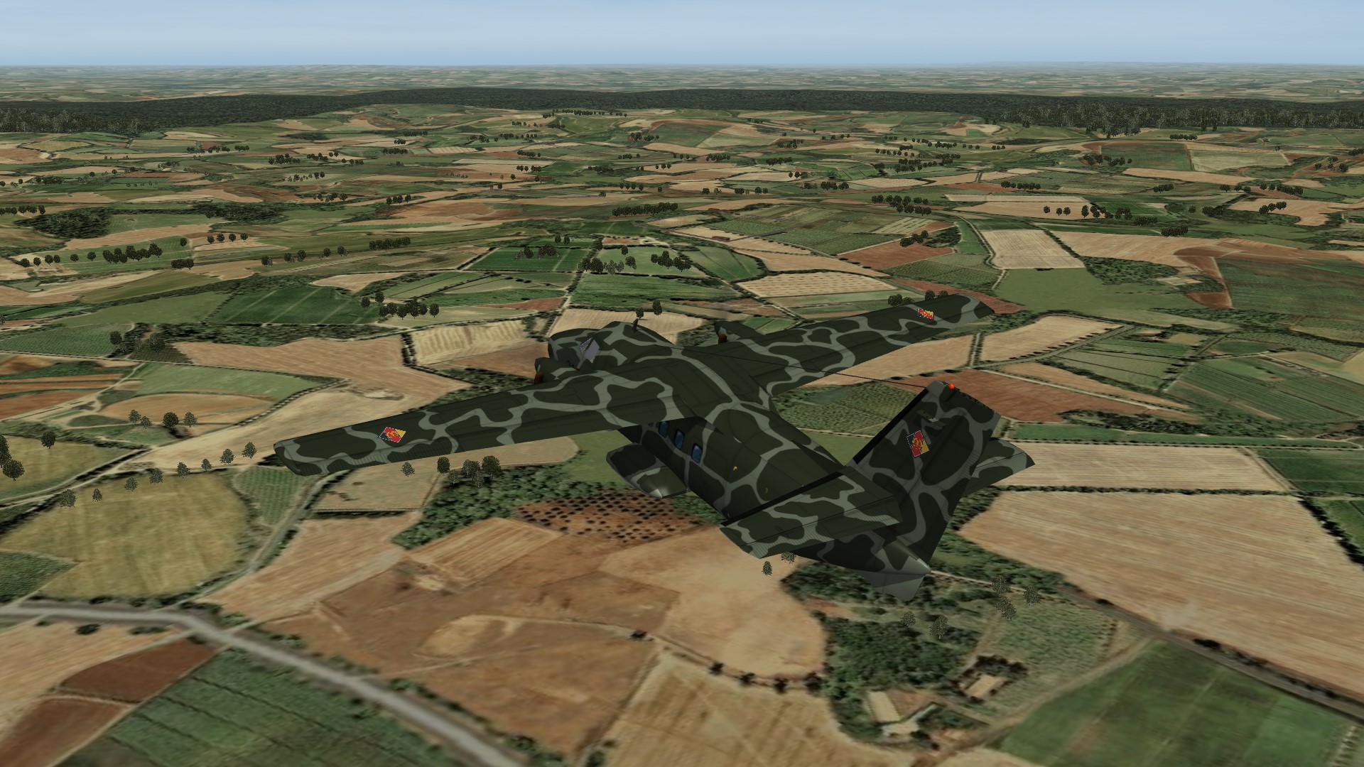
L-410UVP Turbolet. East german "Kaiman" camo.


-
Version 2.0 is uploaded some minutes ago.
-
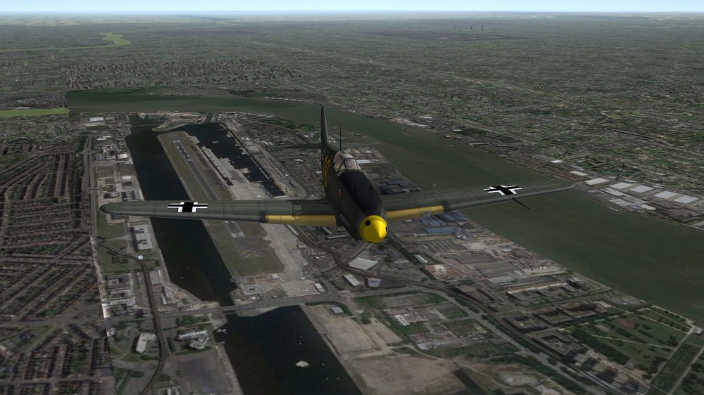
The Mustang would never reach the needed minimum speed to launch an AIM-9B or AIM-4A. But who cares, its a game!
-
Sometimes TW website is not available. This has happen already in the past. I think it has something to do with maintanance.
-
L-410UVP-T westgerman insignia, east german camo East german L-410UVP-T with correct tactical number
-
I'm working on an update to correct some small mistakes. Changes will be: some settings in flightmodel will be changed to make the plane landing properly. position of exhaust emitter will be corrected. add armed_recon to possible missions (you can drop now grenades on trucks ;-) ) new skin for west german use and correct tactical numbers for east and westgerman Air Force. (I got all these files from Paulopanz) Give me some days for final checks. Release till weekend, i hope so.
-
Its flown as prototype. So it is no "What if". mandatory screenshot
-
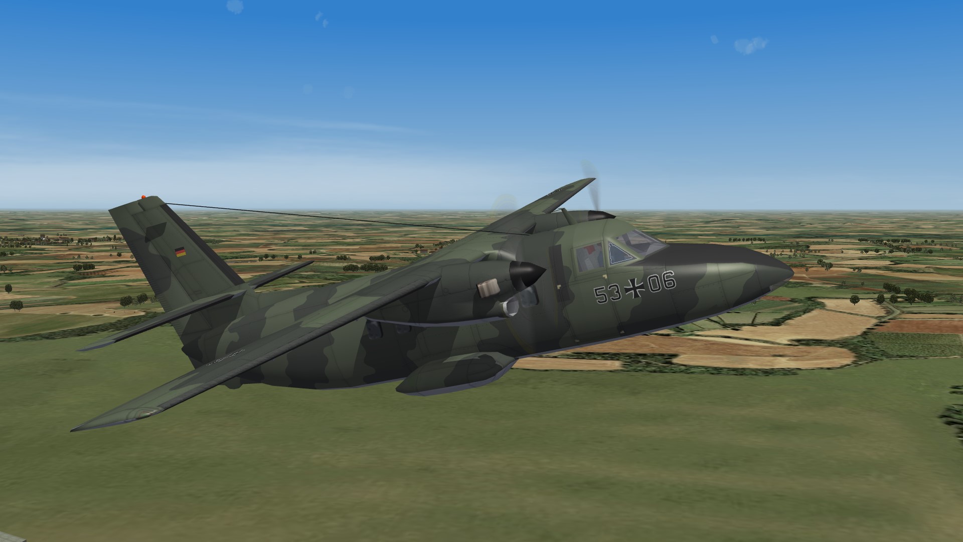
View File L-410UVP-T L-410UVP-T Turbolet ***************************************************** This mod is made for SF2. ---------------------------------------------------------- I. History The czech made L-410UVP light passenger and transport plane was developed to replace the old AN-2 biplanes. After a first version, called L-410A, the soviet Aeroflot airline demanded some changes, including better short take off capabilities. So the version L-410UVP was developed and widely exported in the COMECON states. The east german air force LSK, purchased 10 planes in 1980. They used it as training airplane for tranport pilots and navigators and for transport tasks. Parachute missions were made with the subversion L-410UVP-T (t- stands for Transport). VIP transport was made with subversion L-410UVP-S (s stands for Salon). Both versions were easy to discriminate. The T version had a black rubber plate behind the side door. ----------------------------------------------------------------------- II. CREDITS: While making the L-410UVP-T i used a lot of files made by other modders. Thanks for this files! The LOD file is made: ~~~~~~~~~~ MontyCZ The skin based: ~~~~~~~~~~~ on MontyCZ's latvian skin, modified by me. The flight model is made : ~~~~~~~~~~~~~~~~ by MontyCZ and modded by me The Cockpit is made ~~~~~~~~~~~~~~ by Florian ~~~~~~~~~~~~~~~~~~~~~ The airborne ranger is made ~~~~~~~~~~~~~~~~~~~~~~ by Florian, modified by me ---------------------------------------------------------- III. INSTALLATION: -Unzip the folders into your object folder ---------------------------------------------------------- IV. For remarks, comments, bugs, etc please use the forum or send me a PM. ------------------------------------------------------------- V. The L-410UVP-T and all other files are FREEWARE. COMMERCIAL USE IS NOT ALLOWED! ------------------------------------------------------ ------------------------------------------------------------ Hope you enjoy it. Michael (Gepard) Made in Germany April 2020 Submitter Gepard Submitted 04/05/2020 Category Other Origin
-

Version 2.0.0
246 downloads
L-410UVP-T Turbolet ***************************************************** This mod is made for SF2. ---------------------------------------------------------- I. History The czech made L-410UVP light passenger and transport plane was developed to replace the old AN-2 biplanes. After a first version, called L-410A, the soviet Aeroflot airline demanded some changes, including better short take off capabilities. So the version L-410UVP was developed and widely exported in the COMECON states. The east german air force LSK, purchased 10 planes in 1980. They used it as training airplane for tranport pilots and navigators and for transport tasks. Parachute missions were made with the subversion L-410UVP-T (t- stands for Transport). VIP transport was made with subversion L-410UVP-S (s stands for Salon). Both versions were easy to discriminate. The T version had a black rubber plate behind the side door. ----------------------------------------------------------------------- II. CREDITS: While making the L-410UVP-T i used a lot of files made by other modders. Thanks for this files! The LOD file is made: ~~~~~~~~~~ MontyCZ The skin based: ~~~~~~~~~~~ on MontyCZ's latvian skin, modified by me. The flight model is made : ~~~~~~~~~~~~~~~~ by MontyCZ and modded by me The Cockpit is made ~~~~~~~~~~~~~~ by Florian ~~~~~~~~~~~~~~~~~~~~~ The airborne ranger is made ~~~~~~~~~~~~~~~~~~~~~~ by Florian, modified by me ---------------------------------------------------------- III. INSTALLATION: -Unzip the folders into your object folder ---------------------------------------------------------- IV. For remarks, comments, bugs, etc please use the forum or send me a PM. ------------------------------------------------------------- V. The L-410UVP-T and all other files are FREEWARE. COMMERCIAL USE IS NOT ALLOWED! ------------------------------------------------------ ------------------------------------------------------------ Hope you enjoy it. Michael (Gepard) Made in Germany April 2020 -
True, but see it from a strategic point of view. Under president Obama the USA politicians believed that Russia is the major threat for the US dominance of the world. But Trump realized, that China is the big enemy of tomorrow. Chinas influence has to hedged. For India China is an opponent too. If it would come to a conflict between India and China the chinese influence on France could be so massive, that France would sell no more planes or spareparts to India. With the antagonism between USA and China, India can be sure that the USA would never to yield to the pressure of China. So the supply of weapons and spareparts would be safe for India.
-
 Has someone of you an idea how to place a pilot and his seat so, that he is looking sidewards or backwards?
 -
Since Russia or Europe cant offer a real successor for the MiG-21, the F-21 is the best choice for India, i think.
-
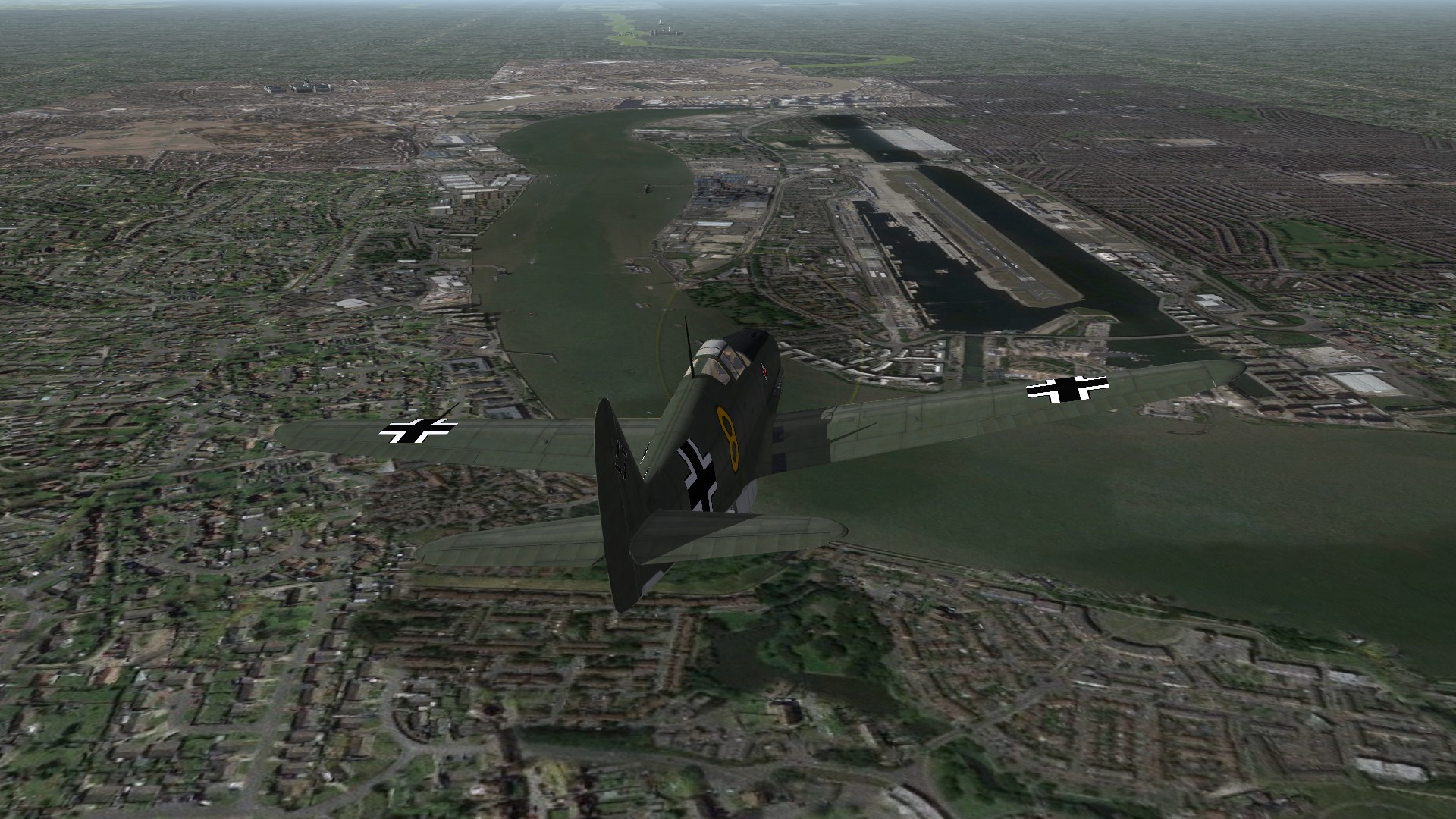
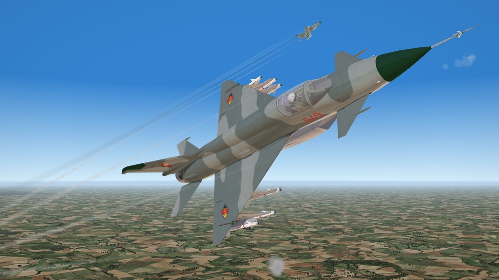
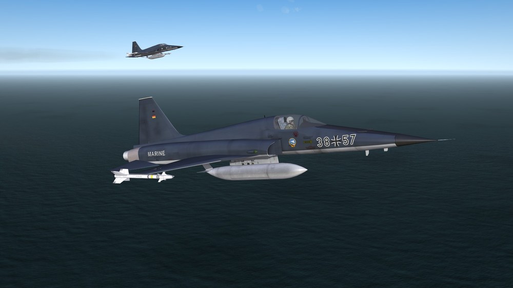
What if the US Marines would have used the F-5E Tiger


-
German Navy Tigers.
-
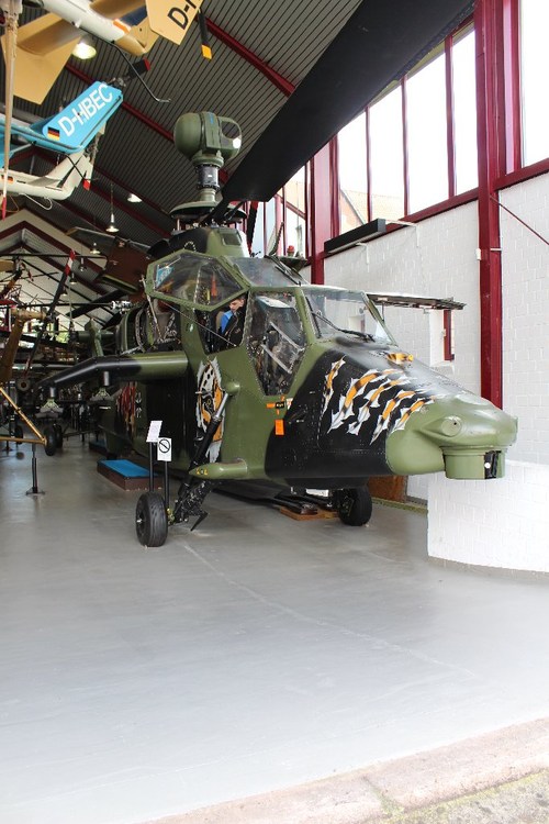
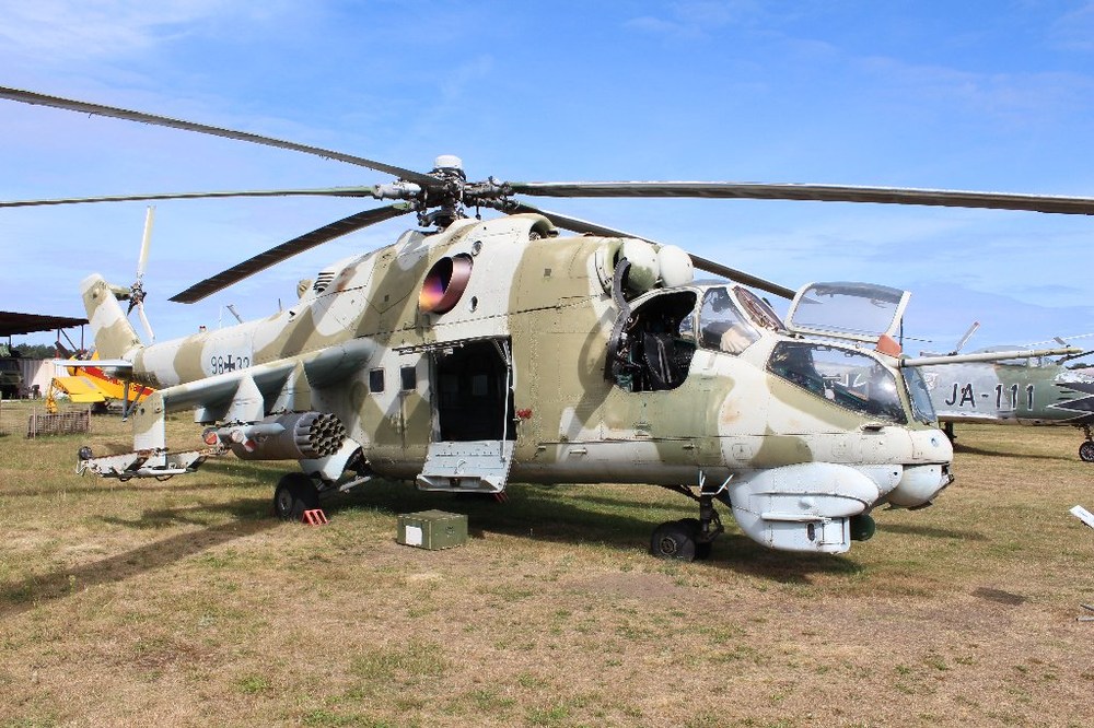
For me the Mi-24 was a childhood dream. To fly this helicopter was my desired career. But i was unable to pass the medical checks and was phased out. When i wrote the book i asked the Museum at Cottbus airport (Flugplatzmuseum Cockpit) whether they would allow me to make a walkaround photoshoot of their Mi-24D. They agreed and opend all doors and hatches and cockpits of the Mi-24, especially for me. So i could climb into the cockpits for pilot and gunner. And i felt comfortable there, like in a very good car. I had an excellent view forward and sideward. The side armour protection was up to my shoulders and the front cockpit glas was thick, very thick. The cockpit was compared with soviet fighter planes spacious. A very good feeling. Thats the Mi-24D at Cottbus. All doors open for me. Some years later i had the chance to climb in the cockpit of the Eurocopter Tiger. One prototype is now displayed at Bückeburg Helicopter Museum. I asked the guys there and they opened the cockpit for me. And i could climb in, could sit where Pierce Brosnan was sitting some years ago! Yes it was the Tiger prototyp you have seen at James Bond movie "Golden Eye". I was sitting in James Bond seat! Wow! But to be honest. The cockpit of the Mi-24 is better. It is bigger and you felt much safer in the Mi-24 than in the Tiger. Here a photo of the James Bond Tiger What i want to say is, there are special days in museums. Days where no much visitor traffic is and the staff is bored. At some days you have the chance to make special experiences. Perhaps you will get the chance to sit in a Mi-24. Its worth trying.
-
I dont know, how exactly the flightmodel of the Mi-24 in DCS would be. In reality the Mi-24 was a big step forward. It was completly different from the Mi-8. One of the east german Mi-24 pilots descriped it so: "Flying the Mi-24 feels like driving a fast motorbike. But which bike can reach 300 km/h? The needed movement of the stick is very small. It has only the size of a 5 Mark coin." The 5 Mark coin had had a diameter of 29 mm. What means that you needed a lot of feeling to fly this helicopter. The Mi-8 flying was said was like driving a small van or small truck. It was a reliable, stable flying helicopter. My own experience with the Mi-8 was, that we had 3 of them at Nordhausen, when i served out my military time as a Sergeant. (I finished my military duty at the rank of a Unterfeldwebel (Staff Sergeant). Always when a helicopter came out a routine check it had to be flight tested. One of the test was to fly the heli fully loaded. To make it easy and fast the heli was not loaded with weights or cargo, but with men. All folks available had to climb in the cargobay of the Mi-8. And then: here we go! In the hand of an experienced pilot the Mi-8 behaved like a bus. Smooth and comfortable. Okay, it was loud. Our Mi-8 were military and had not had the sound damping interior paneling of civil Mi-8s. But else it was a very good feeling to sit in the Mi-8 looking out of the window and the best was, that it was a flight for free! But one time, i was assigned to take a television to another of our 3 landing points and the one of the pilots was a greenhorn, fresh from pilots school. He was the No 2 pilot. The No 1 pilot was the commander of the squadron. When the commander was flying the Mi-8 was stable like a bus, when the greenhorn was taking over it behaved like a small boat in high waves. That was not a really nice experience. But worth. My only flight with a Mi-24 was terrible. During one of my trainings we visited a soviet helicopter base. They showed us all what they had, helicopters and weapons, even the the ODAP bombs. "That we usually dropped in an afghan village before the ground troops started an attack." they told us, "Usually one is enough to flatten one village." And then the invited us to have a flight with a Mi-24. One crew was assigned to make a low level mission at treetop height. Okay, i thought, no problem at all. When our pilots flew at treetop hight it means flying straight away at 30 m. I thougt the soviets did it in the same way. My fault. The soviet crew came fresh from Afghanistan. And they flew like in Afghanistan. For them meant flying at treetop height, that the highest point of the helicopter was allowed to be at 30 meters. Maximum, better is to be lower, much lower! At fast speeds the nose of the Mi-24 is going down. Sitting in the cargo bay it felt like sitting on an inclined plane. This was terrifying enough. More terrifying was that i got the feeling, that the helicopter pilot was trying to scratch the soil with the gun of the helicopter. So low we were flying. And then started the roller coaster. When an obstacle was in the flight path the heli "jumped" over it, only to sink down to former very low altitute in less than a second. The first 3 or 4 of that stunts were fun. But afterwards i started to become airsick. Holy moly! What a mess! I tore my steel helmet from my head and used it as spittoon. After landing my spittoon was nearly completly filled and i saw things in it, that I couldn't remember to have eaten. Oh my! Never again!!!! Mi-24 pilots are mad!!!!
-
I hope you get it faster. And I'd like to hear how you liked the book.
-
Perhaps you should try to look for the european Meteor missile. Looks more or less similar to the PL-15. Little bit ini modding. Thats it.